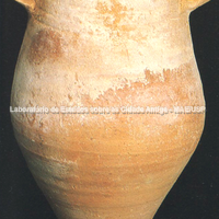
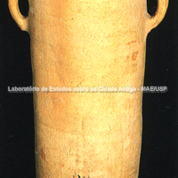
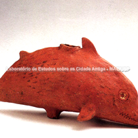
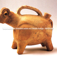
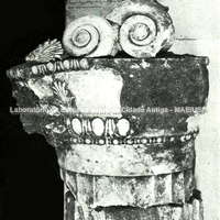
Carthage

North Africa (Tunisia)

Carthage (Qart Hadasht, Phoenician for "new city") was a Tyrian colony – that is, of the Phoenician city of Tyre (Syro-Palestine) – founded on the promontory of Cape Bon, in the area of the present-day city of Tunis, Tunisia, North Africa.
Accounts of its foundation in the textual sources converge on the date of 814 BC, and indeed archaeological excavations at the site of Carthage have revealed foundations from the first half of the 8th century BC.
Since a settlement is thought to take a few decades to become materially visible, the date of 814 BC has been accepted by researchers as credible.
In 1979 the archaeological site of Carthage was declared a World Heritage Site. Since then, excavation campaigns have been carried out by Tunisian and international teams under UNESCO sponsorship.
Today the site is part of the Carthage-Sidi Bou Said National Park.

Borders

Natural features: rivers, topography, sea

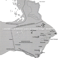
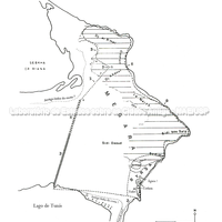
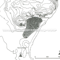
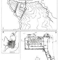
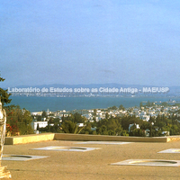
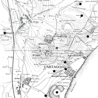
This set of maps of Carthage shows the division of the territory of the peninsula on which the city developed. The isthmus connecting it to the North African mainland is 4,440 metres wide. It is a typically Phoenician site: facing the sea, and thus also relying on its protection, with land control of the point of contact with the hinterland and the indigenous populations beyond.
The coastline has changed considerably since antiquity. The map Krings, 1995, p.380 below reconstructs the possible ancient coastlines, which is important, for example, for identifying the first harbour of Carthage, which would have been located south of the 3rd-century BC harbours.
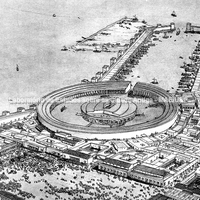
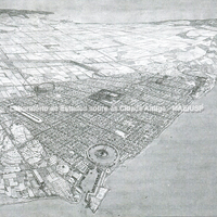
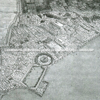
The map Guzzo 2007, p.60 shows the main areas identified today on the Punic site: the harbours (3rd century BC – later monumentalised by the Romans); the tophet (open-air children's sanctuary dating from the beginning of the city's foundation); residential areas; an open area thought to have served as a meeting place (agora?). Also visible are the hills surrounding the core of the Punic city: Byrsa (Phoenician Barsat = fortress), Juno and, to the north, Megara, an agricultural suburb. The necropoleis likewise extended from the Byrsa hill to the north of the site, covering, besides Byrsa, the Juno hill and the area between the sea, to the east, and the Odeon plateau. The first image, Slim 2003, p.79a, shows a reconstruction of the Punic city in the 3rd century BC.
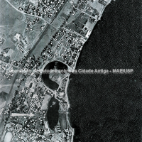
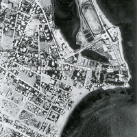
The 3rd-century BC harbours can be seen in the images Slim 2003, p.79a; p.95a; Safar 2004.
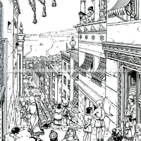
The heart of the Punic city lay on a coastal plain and was protected by a ring of hills on which, initially, as mentioned above, the city's necropoleis developed (the Borj-Djedid and Odeon plateaus; the Juno and Byrsa hills), and which, with the growth of Carthage from the 4th–3rd centuries BC, ended up being reused for housing, as in the case of the main hill, Byrsa.
This core was protected by a wall on the isthmus, to the west, almost 33 km long. The southern part of the site was marshy and concentrated the metalworking and glassmaking areas. It is believed that the first harbour, tentatively located in this area, was abandoned because of these topographical conditions.
From the 4th century BC the initial core expanded northwards, forming Neapolis ("new city"). The city then extended even further north into a large semi-rural suburb called Megara, as can be seen in the image Mahjoubi 2002, p.9apt.
Bibliography (6)
  • Guzzo, M. G. A.; Carthage
  • Ennabli, A.; Mahjoubi, A.; Slim, H.; Belkhoja, K.; Histoire générale de la Tunisie.
  • Krings, V. (ed.); La Civilisation Phénicienne et Punique. Manuel de recherche.
  • Benichou-Safar, H.; Le tophet de Salammbô à Carthage. Essai de reconstitution.
  • Mahjoubi, A.; Punic Tunisia: 6th century B.C. to 146 B.C.
  • Moscati, S. (ed.); The Phoenicians.

Views of the hill of Sidi Bou Saïd

Forms of occupation of the khóra

Fortifications

Fortifications.

Bibliography (3)
  • Picard, C. G.; Carthage, a survey of Punic history and culture from its birth to the final tragedy,
  • Krings, V. (ed.); La Civilisation Phénicienne et Punique. Manuel de recherche.
  • Moscati, S. (ed.); The Phoenicians.

Forms of occupation of the khóra

Residential areas: villages, farmsteads

Rural land registry.

Bibliography (2)
  • Ennabli, A.; A Site of Cultural and Natural Interest, Carthage.
  • Bollati, R.; Bollati, S.; Siracusa: genesi di una città. Tessuto urbano di Ortigia.

Forms of occupation of the ásty

Residential areas

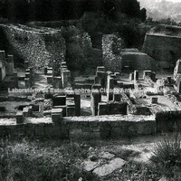
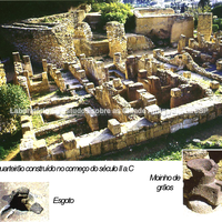
Residential area of Byrsa.

Bibliography (5)
  • Lancel, S.; Byrsa I: Rapports préliminaires des fouilles (1974-1976).
  • Guzzo, M. G. A.; Carthage
  • Ennabli, A.; Mahjoubi, A.; Slim, H.; Belkhoja, K.; Histoire générale de la Tunisie.
  • Krings, V. (ed.); La Civilisation Phénicienne et Punique. Manuel de recherche.
  • Moscati, S. (ed.); The Phoenicians.
Houses.

Bibliography (4)
  • Ennabli, A.; Mahjoubi, A.; Slim, H.; Belkhoja, K.; Histoire générale de la Tunisie.
  • Krings, V. (ed.); La Civilisation Phénicienne et Punique. Manuel de recherche.
  • Markoe, G.; Phoenicians.
  • Moscati, S. (ed.); The Phoenicians.

Residential quarter of Mago.

Bibliography (2)
  • Ennabli, A.; A Site of Cultural and Natural Interest, Carthage.
  • Ennabli, A.; Mahjoubi, A.; Slim, H.; Belkhoja, K.; Histoire générale de la Tunisie.

Forms of occupation of the ásty

Urban grid: acropolis, block, agora, plateiai, stenopoi, orientation

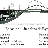
Byrsa.

Bibliography (6)
  • Lancel, S.; Byrsa II: Mission Archéologique Française à Carthage. Rapports préliminaires sur les fouilles 1977-1978: niveaux et vestiges puniques.
  • Lancel, S.; Byrsa I: Rapports préliminaires des fouilles (1974-1976).
  • Ennabli, A.; Mahjoubi, A.; Slim, H.; Belkhoja, K.; Histoire générale de la Tunisie.
  • Krings, V. (ed.); La Civilisation Phénicienne et Punique. Manuel de recherche.
  • Benichou-Safar, H.; Le tophet de Salammbô à Carthage. Essai de reconstitution.
  • Moscati, S. (ed.); The Phoenicians.
Forms of occupation of the ásty

Walls and position of the gates

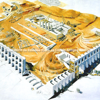
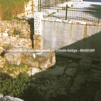
According to the textual sources, a great wall almost 33 km long protected the core of Carthage on the Cape Bon peninsula, representing an area of 250 ha. Appian (Libyca, 95) speaks of a triple western wall that crossed the isthmus for almost 5 km, protecting the city and its suburbs from the North African mainland. It is thought to have been a defensive system made up of three distinct elements: a ditch, a palisade on an earth bank, and the wall proper. Again according to Appian, the wall was 9 metres wide and 15 metres high. It was crenellated and divided by towers at intervals of 60 metres. It had two storeys: below, stables could hold up to 300 elephants; above, the stables could accommodate up to 4,000 horses. The upper storey also housed stores of fodder and barley and quarters for 20,000 infantrymen and 4,000 cavalrymen.
Archaeologically, this whole complex has not yet been attested in such detail. Nevertheless, this description from the Roman period, when the memory of Carthaginian power was still alive, is striking. It is therefore thought that such a sophisticated wall was contemporary with the alterations made to the harbours, and thus dates from the 3rd century BC.
To the south, this wall would have been single, skirting the Lake of Tunis and ending at the gates of the commercial harbour. To the north, where the topography is steeper (Gammarth, La Marsa and Sidi Bou Saïd), there would likewise have been a single wall crowning the high ground.
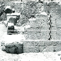
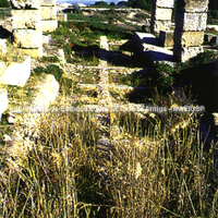
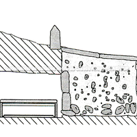
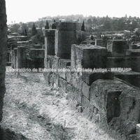
Portions of this defensive and territorial demarcation system have been revealed archaeologically – for example, as seen in the image Ennabli 2005, p.33b, and the reconstruction in Slim 2003, p.89b – through the work of the German team at Carthage. This team identified not only the foundations of the Carthaginian wall at several points along the coastline, but also, reused, blocks from the elevation and toothed blocks belonging to the crowning of the walls. Interestingly, these blocks have a strikingly white coating, which has been interpreted as a Hellenistic feature.

Bibliography (4)
  • Ennabli, A.; A Site of Cultural and Natural Interest, Carthage.
  • Benichou-Safar, H.; Le tophet de Salammbô à Carthage. Essai de reconstitution.
  • Mahjoubi, A.; Punic Tunisia: 6th century B.C. to 146 B.C.
  • Moscati, S. (ed.); The Phoenicians.
Forms of occupation of the ásty

Sacred areas: deposits, temples, shrines, sanctuaries, altars

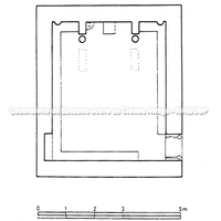
Carton Chapel.

Bibliography (1)
  • Krings, V. (ed.); La Civilisation Phénicienne et Punique. Manuel de recherche.

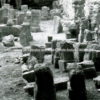
Tophet.

Bibliography (6)
  • Ennabli, A.; A Site of Cultural and Natural Interest, Carthage.
  • Picard, C. G.; Carthage, a survey of Punic history and culture from its birth to the final tragedy,
  • Ennabli, A.; Mahjoubi, A.; Slim, H.; Belkhoja, K.; Histoire générale de la Tunisie.
  • Krings, V. (ed.); La Civilisation Phénicienne et Punique. Manuel de recherche.
  • Markoe, G.; Phoenicians.
  • Moscati, S. (ed.); The Phoenicians.
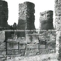
Chapel at Sidi Bou Saïd.

Bibliography (1)
  • Krings, V. (ed.); La Civilisation Phénicienne et Punique. Manuel de recherche.

Forms of occupation of the ásty

Work areas: workshops

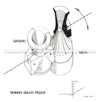
Mill.

Bibliography (1)
  • Lancel, S.; Byrsa II: Mission Archéologique Française à Carthage. Rapports préliminaires sur les fouilles 1977-1978: niveaux et vestiges puniques.

Forms of occupation of the khóra

Work areas

Quarries of El Haouaria.

Bibliography (1)
  • Ennabli, A.; A Site of Cultural and Natural Interest, Carthage.

Museum

Archaeological object

Archaeological objects.

Forms of occupation of the ásty

Relationship and connections between the urban grid and the harbour

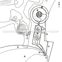
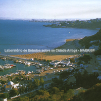
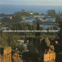
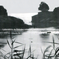
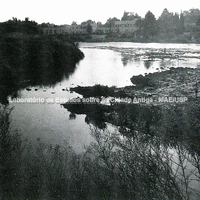
The images Moscati 1999, p.61 and 210; Safar 2004, plates III and IV; Ennabli 2005, p.12a and Mahjoubi 2002, p.11c all show, in present-day aerial views and ground photographs, the two lagoons that in antiquity formed the famous military (circular lagoon) and commercial (rectangular lagoon) harbours of Carthage.
The image Krings 1995, p.380 shows:
1. Tophet; 2. water basin of the circular harbour; 3. water basin of the rectangular harbour; 4. Falbe quadrilateral (chôma); 5. access to the harbours, sheltered by the end of the chôma breakwater.
This is how Polybius described the Carthaginian harbours at the time of the Third Punic War (adapted text):
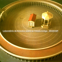
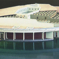
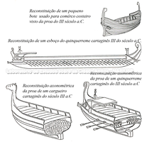
"The harbours communicate with each other. One enters from the open sea through a single passage more than 20 metres wide, usually closed by iron chains. The first harbour sheltered merchant ships (rectangular lagoon), and the most varied kinds of moorings were found there. In the inner harbour (circular lagoon) there is an islet right in the middle. Both the island and the harbour were divided by large embarkation areas. These embarkation areas had docks built to house 220 ships. Each dock had chambers to house the equipment needed to manoeuvre the triremes. Each dock was flanked by an Ionic column, which gave the harbour the appearance of a portico. On the islet a pavilion was built for the commander of the warships (nauarchos); from this pavilion the trumpet announced movements, the heralds gave orders and the commander had direct control of everything that happened" (Appian, Libyca, 96).
One point that has attracted attention since antiquity is Carthaginian ingenuity. Taking advantage of the topography of the site, Carthage managed to arrange the two harbours essential to its existence, the commercial and the military, so that the first was open to its surroundings, and therefore to the Mediterranean, while the second was protected from spying.

Bibliography (6)
  • Guzzo, M. G. A.; Carthage
  • Ennabli, A.; Mahjoubi, A.; Slim, H.; Belkhoja, K.; Histoire générale de la Tunisie.
  • Krings, V. (ed.); La Civilisation Phénicienne et Punique. Manuel de recherche.
  • Benichou-Safar, H.; Le tophet de Salammbô à Carthage. Essai de reconstitution.
  • Mahjoubi, A.; Punic Tunisia: 6th century B.C. to 146 B.C.
  • Moscati, S. (ed.); The Phoenicians.
Forms of occupation of the ásty

Water management: channels, cisterns, wells

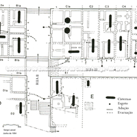
Water supply.

Bibliography (1)
  • Benichou-Safar, H.; Le tophet de Salammbô à Carthage. Essai de reconstitution.

Forms of occupation of the khóra

Funerary spaces: necropoleis, scattered burials

Necropolis.

Bibliography (2)
  • Krings, V. (ed.); La Civilisation Phénicienne et Punique. Manuel de recherche.
  • Moscati, S. (ed.); The Phoenicians.
Reconstructions

Reconstructions

Reconstructions.

Bibliography (3)
  • Ennabli, A.; A Site of Cultural and Natural Interest, Carthage.
  • Lancel, S.; Byrsa II: Mission Archéologique Française à Carthage. Rapports préliminaires sur les fouilles 1977-1978: niveaux et vestiges puniques.
  • Moscati, S. (ed.); The Phoenicians.
migration

images from the old database

Architectural detail.