Selinous

Sicily (West Coast)

Selinous was a sub-apoikia of Megara Hyblaea, founded at the end of the 7th century BC on the south-western coast of Sicily. It was a very prosperous apoikia, which already in 570 BC founded its own sub-apoikia, Herakleia Minoa, on the way to Akragas. In 409 BC it was destroyed by the Carthaginians and thereafter remained in Carthaginian hands, except for a brief period when it was occupied by Dionysius of Syracuse at the beginning of the 4th century BC. In 250 BC, during the First Punic War, the city was abandoned.

Forms of occupation of the ásty

Sacred areas: deposits, temples, shrines, sanctuaries, altars

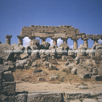
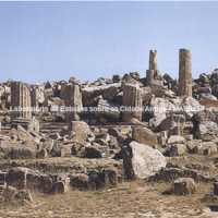
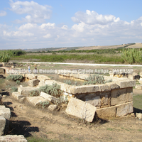
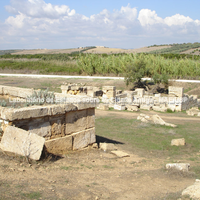
Temple B is considered Hellenistic, dated between the 4th and 3rd centuries BC. It stands beside temple C in the main sanctuary on the acropolis of Selinous. Its order is Doric.

Mertens (2010) studies all the variations of the Doric style at Selinous.
Bibliography (3)
  • Mertens, D.; Città e monumenti dei Greci d’Occidente.
  • Mertens, D.; L'architettura templare
  • Carratelli, G. P.; Sikanie: Storia e civiltà della Sicilia greca.
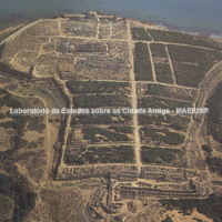
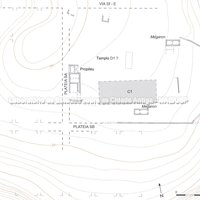
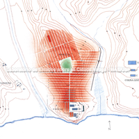
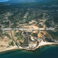
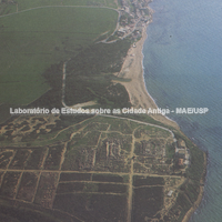
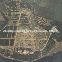
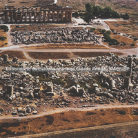
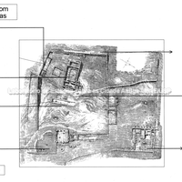
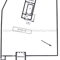
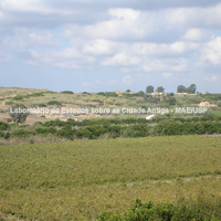
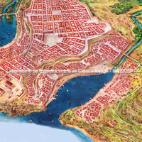
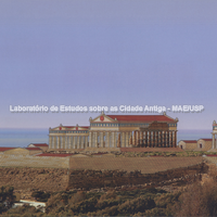
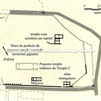
These plans and reconstructions show the space of the temenos of Temple C on the acropolis of Selinous. The images correspond to the various periods of development of this temenos, dated respectively from 650 to 560 BC, from 560 to 500 BC, and to the 5th century BC. We have also included an image of the same space in the Hellenistic period. It is interesting to observe how the same space is readapted to different needs. A space that was sacred in the Archaic and Classical periods came to house an agora and spaces for meetings of all kinds, including commercial ones. The plan of the acropolis of Selinous clearly shows the position of the temenos of Temple C. Likewise, the aerial view shows the remains of the acropolis today.

Bibliography (7)
  • Borgia, E.; Messineo, G.; Ancient Sicily.
  • Mertens, D.; Città e monumenti dei Greci d’Occidente.
  • Labeca,; Foto Acervo Labeca
  • Hellmann, M.; L’ Architecture Grecque. 1. Les principes de la construction.
  • Coarelli, F.; Torelli, M.; Sicilia - Guide Archeologiche Laterza.
  • Carratelli, G. P.; Sikanie: Storia e civiltà della Sicilia greca.
  • Carratelli, G. P. (ed.); The Greek world: art and civilization in Magna Graecia and Sicily.

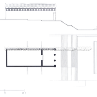
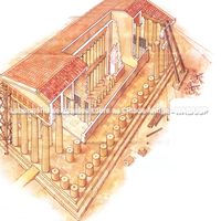
Temple A, built in the temenos of temple C on the acropolis of Selinous, is dated to 450 BC; it is Doric, measures 16 x 40 metres and has a distyle in antis pronaos and opisthodomos, a naos and perhaps an adyton. The chronology of temple A and also of temple O is uncertain because of the lack of excavation data and the relative scarcity of stylistic elements. However, the relatively canonical type of their plans allows them to be dated between 490 and 460 BC, placing them in the phase of aristocratic government (Coarelli; Torelli, 1984: 90; De Angelis, 2003: 138). The "twin" appearance of the two buildings has led researchers to think that they were dedicated to Apollo and Artemis (De Angelis, 2003: 138).

Bibliography (5)
  • Mertens, D.; Città e monumenti dei Greci d’Occidente.
  • Angelis, F. d.; Megara Hyblaea and Selinous: The Development of two Greek City-states in Archaic Sicily.
  • Coarelli, F.; Torelli, M.; Sicilia - Guide Archeologiche Laterza.
  • Carratelli, G. P.; Sikanie: Storia e civiltà della Sicilia greca.
  • Minà, P.; Urbanistica e architettura nella Sicília greca.

Temple D is also located in the area of the main sanctuary on the acropolis of Selinous, in the so-called temenos of Temple C.
The building stands at the highest point of the acropolis, 20 metres north-west of temple C. It was a Doric pseudodipteros, 24 x 56 metres, with 6 x 13 columns. The cella is tripartite, with a distyle in antis pronaos, naos and adyton. The building is dated to 550 BC and attributed to the cult of Athena on the basis of two 5th-century BC inscriptions (De Angelis, 2003: 129-130; Veronese, 2006: 518-519).
Temples C and D, A and O gave the whole southern half of the acropolis hill a sacred meaning and a peculiar monumental value, forming, together with the temples of the eastern hill, a crown of majestic sacred buildings as at Akragas (Di Vita, 1996: 288-289).

Bibliography (5)
  • Mertens, D.; Città e monumenti dei Greci d’Occidente.
  • Angelis, F. d.; Megara Hyblaia and Selinous: The Development of two Greek City-States in Archaic Sicily.
  • Carratelli, G. P.; Sikanie: Storia e civiltà della Sicilia greca.
  • Vita, A. D.; Urbanistica della Sicilia Greca
  • Minà, P.; Urbanistica e architettura nella Sicília greca.

Museum

Archaeological object

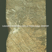
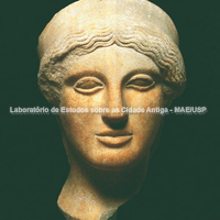
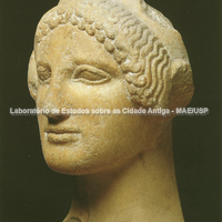
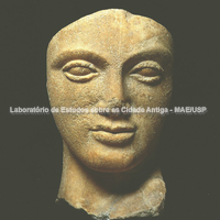
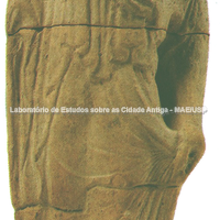
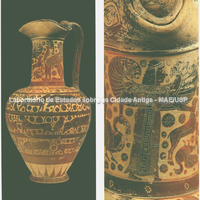
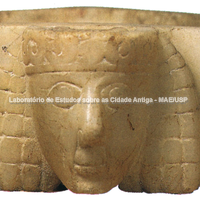
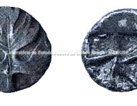
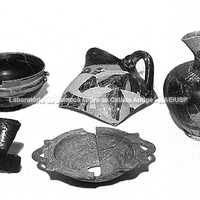
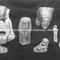
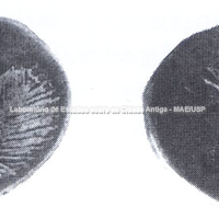
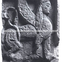
This group of pieces has been selected to give an idea of some types of objects from this city.
Note that the coins bear the emblem of a celery leaf: sélinon in Greek.

Bibliography (5)
  • Institut, D. A.; Archäologischer Anzeiger. (2003)
  • Stefano, C. A. d.; Moscati, S.; Museu Archeologico,
  • Holloway, R. R.; The Archaeology of Ancient Sicily.
  • Carratelli, G. P. (ed.); The Greek world: art and civilization in Magna Graecia and Sicily.
  • Minà, P.; Urbanistica e architettura nella Sicília greca.

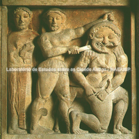
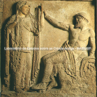
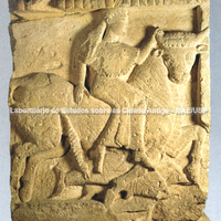
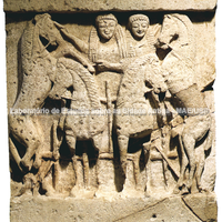
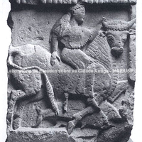
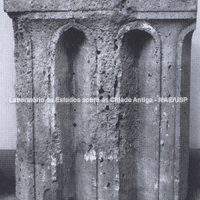
Architectural elements of the temples of Selinous. A set of ceramic metopes. Metopes were set between one triglyph and the next on the architrave of temples. They depict mythical episodes, and their study often makes it possible to identify the deity to which a temple was dedicated and the date of the building. In-depth study of the metopes also allows us to explore religious conceptions and the functions of religion in the ancient city.

In these photographs of metopes it is also interesting to note how their details are revealed differently in black-and-white and in colour photos. The scientific discourse built on these images is necessarily shaped by the kind of document we have before us.

Bibliography (3)
  • Stefano, C. A. d.; Moscati, S.; Museu Archeologico,
  • Carratelli, G. P. (ed.); The Greek world: art and civilization in Magna Graecia and Sicily.
  • Minà, P.; Urbanistica e architettura nella Sicília greca.

Forms of occupation of the ásty

Urban grid: acropolis, block, agora, plateiai, stenopoi, orientation

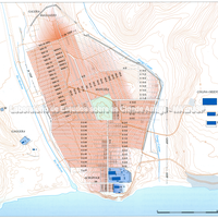
There is much debate about the basic unit of spatial planning in the polis: blocks? plots? road axes? This image presents comparative measurements of the blocks in the different areas of Selinous.
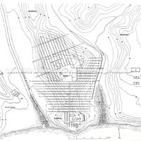
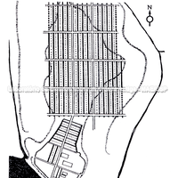
The topography of the settlement is uneven, and some authors note that part of the principles of specialisation of the city's spaces took this factor into account to make better use of the land. Consider the two ends, east and west, in the north of Manuzza: the north–south streets deviate by 22 degrees to the west in relation to the grid of the acropolis, allowing the land to be optimised (Mertens 2010: 100). The junction of the two street systems – that is, the connection between the acropolis and the Manuzza plateau – consists of an almost flat, trapezoidal area which later (not in the phase of frequentation 750–600 BC) came to house the agora (Mertens, 2005: 31). This position and trapezoidal shape – peculiar if taken in isolation – is connected with the arrangement of the specialised spaces of the mother city, Megara Hyblaea. On the implications of the relational aspects of the urbanism of Selinous and Megara Hyblaea, see Christiane Teodoro Custodio's Master's dissertation, especially chapter 4.
In the street systems of the acropolis and the Manuzza plateau, the distance between the stenopoi defining the blocks averages 32.80 m = 100 feet. For Mertens this indicates a mechanism aimed at a first division of the urban area; the aim may not primarily have been the articulation of the streets but, above all, an allocation arrangement apparently similar to that used in the subdivision of the agricultural hinterland, the khóra (Mertens, 2010: 100).
The built area of the houses increased progressively during the 6th century BC. This has fed the debate on the size of the plots assigned to the colonists at different phases of the city's development. The insulae bordering the agora of Selinous are divided into residential plots (oikopeda) of identical size (the same is true at Megara Hyblaea). Houses were built within these subdivisions from the 7th century BC. This division is similar at various points of the settlement and remained the usual unit of size until the destruction of the city in 409 BC. The plots are square, measuring 14.50 m of built area and 210–215 m² of surface, which Mertens (2010) interprets as double the plot units at Megara Hyblaea, indicative therefore of the ambitions of the colonial foundation; moreover, this seminal base unit may have determined the dimensions of the whole insula. Two adjoining plots set the width and length, and their multiples necessarily set all the oikopeda, which were separated by spaces providing water supply and ventilation (Mertens, 2010: 104). For further considerations on the relationship between plot dimensions and the street grid, see Christiane Teodoro Custodio's Master's dissertation (2012), especially pp. 89-93.

Absolute dates obtained at distinct and equidistant points in the urban area show that, in parallel with the laying out of the street grid, the walls of the Cottone river valley were built, and possibly the entire layout of the ásty was already integrated with the specialisation observed in the sanctuary of the acropolis and the agora (Danner, 1997: 154; Mertens 2010: 100).

Bibliography (5)
  • Custodio, C. T.; Khóra e ásty nas pólis grgas do Ocidente: o caso de Selinonte
  • Mertens, D.; L'urbanistica della città greca
  • Danner, P.; Megara, Megara Hyblaea and Selinus: the relationship between the town planning of a mother city, a colony and a sub-colony in the Archaic period.
  • Mertens, D.; Selinunte
  • Bollati, R.; Bollati, S.; Siracusa: genesi di una città. Tessuto urbano di Ortigia.

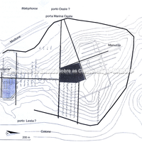
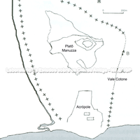
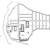
These general plans clearly show the urban organisation of Selinous, its various axes of orientation and the integration of the acropolis with the area called Manuzza. At the same time they represent various stages of archaeological research. At first only the acropolis area was well known, and since this area was enclosed by a wall it was believed to be the city of Selinous. Later the excavations showed that these walls dated from the period of Punic occupation, and were therefore later, and that the Archaic and Classical city extended over the whole inland area of the Manuzza region, with a different street-grid orientation. At the same time, the absence of walls on the west side makes it possible to discuss the limits of the central area of this polis.
In recent decades the German Archaeological Institute has carried out a wide-ranging programme of study of the topography of Selinous. Part of the results, obtained through geophysical survey, revealed the walls bordering the Cottone river valley, which were integrated into the street grid of the first quarter of the 6th century BC. The inner structure of the walls is of the same limestone used in building many Archaic house foundations. Part of the same project was a large (east) gate positioned to protect the great artery linking the urban area with the sanctuary on the eastern hill; the gate was protected by a semicircular bastion (Mertens, 2005: 31). The construction of the walls is also contemporary with the construction of the first monumental public buildings: the peripteral temples on the acropolis, the Megaron (c. 580/570 BC), and on the eastern hill Temple E(2) (c. 600 BC), successor to Temple E(1) built in the 7th century BC (De Angelis, 2003: 135; Mertens, 2005: 31; Veronese, 2006: 518-519).

Bibliography (9)
  • Mertens, D.; Città e monumenti dei Greci d’Occidente.
  • Tréziny, H.; Gras, M.; La mise en place du plan urban.
  • Veronese, F.; Lo spazio e la dimensione del sacro: santuari greci e territorio nella Sicilia arcaica
  • Angelis, F. d.; Megara Hyblaea and Selinous: The Development of two Greek City-states in Archaic Sicily.
  • Mertens, D.; Selinunte
  • Coarelli, F.; Torelli, M.; Sicilia - Guide Archeologiche Laterza.
  • Carratelli, G. P. (ed.); The Greek world: art and civilization in Magna Graecia and Sicily.
  • Minà, P.; Urbanistica e architettura nella Sicília greca.
  • Mertens, D.; Verso l’agorá di Selinunte.

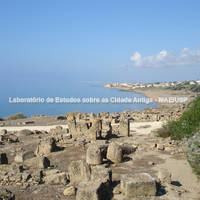
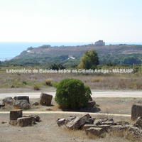
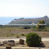
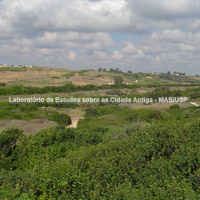
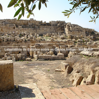
The Acropolis of Selinous was set on a bank 30 metres above sea level. Retaining walls/terraces were built on the outside for protection. An important sacred area occupies a significant part of the acropolis, its largest space being the temenos of temple C. From this acropolis there is a view both to the east (the eastern hill) and to the west (the Gaggera hill), where important sacred areas were established in the khóra.
Although the best-known urban grid of Selinous today was consolidated from the end of the 6th century BC, the street orientation of Selinous had already been defined earlier, when the acropolis was settled. This whole area is connected through an agora to the region known as Manuzza, the area of residential blocks, which had a different street orientation (see the plans of Selinous).
In the Punic period, when the population of Selinous had shrunk, this acropolis was enclosed by walls, which led – before the archaeological excavations at Manuzza – to the belief that the core of Selinous was much smaller.

Bibliography (5)
  • Borgia, E.; Messineo, G.; Ancient Sicily.
  • Mertens, D.; Città e monumenti dei Greci d’Occidente.
  • Labeca,; Foto Acervo Labeca
  • Carratelli, G. P.; Sikanie: Storia e civiltà della Sicilia greca.
  • Minà, P.; Urbanistica e architettura nella Sicília greca.

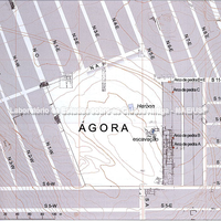
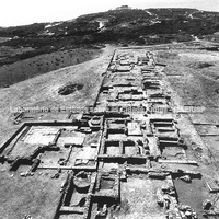
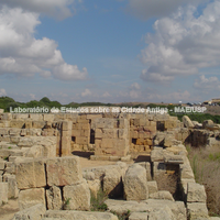
These images show the agora of Selinous in its function of linking two street grids with different orientations. On the larger plan the agora appears within the most densely populated area.
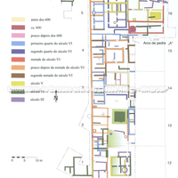
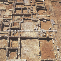
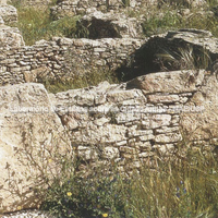
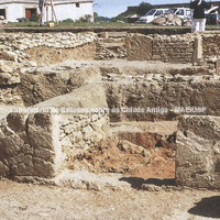
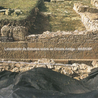
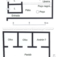
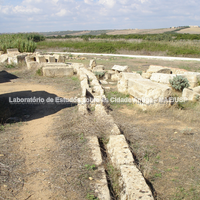
The whole east side of the agora has been excavated, and remains of houses dating from the foundation of the city in the 7th/6th century BC were found there. In this group of images the east side of the agora is clearly visible, and we can also see the plans of some of these houses.
Houses built in the acropolis area, also dated to the 7th century BC, show similarities in masonry and built area to those on the Manuzza plateau. This evidence is used to support the hypothesis that already in the 7th century BC the colonists were implementing a systematic organisation and division of space to define the streets that would make up the urban grid that took shape later (Rallo, 1976-77: 723-725 apud De Angelis, 2003: 128; Coarelli; Torelli, 1984: 73-74). Taking the orientation of the 7th-century BC buildings at Manuzza and on the acropolis together with the dates attributed to the road axes and to the specialisation of civic and sacred spaces observed in the same period, we have indications of a spatial organisation undertaken in the first years of the settlement's development (Danner, 1997: 152). See Christiane Teodoro Custodio's Master's dissertation (2012), especially chapter 3.
In the south-eastern area of the Manuzza plateau there is an Archaic necropolis. Its location and the characteristics of the ground (uneven/sloping, cf. topographical map of the site) may have influenced the layout of the 7th-century BC residential blocks (Rallo, 1984: 91; De Angelis, 2003: 133). Still on aspects of spatial organisation in the 7th century BC, it has been speculated that the starting point of occupation may have been the mouth of the river Gorgo Cottone, where a primitive harbour would have been established, and from which some streets and blocks would have started, with an orientation differing from the one consolidated in the urban grid of the 6th century BC. Excavations in the "primitive harbour" sector revealed that plateiai 0 and 6 were routes used by inhabitants of the settlement in the period before the arrival of the Greek colonists, remaining in use throughout the 7th and 6th centuries BC. This orientation of the 7th-century BC grid is possibly hidden in the archaeological record because of successive building activity in that sector of the settlement, and comparison of this hypothesis with the results of the geophysical survey carried out in the sector is inconclusive; it has received attention from the archaeologists coordinating work at the site (Mertens, 2010: 100-101).

Bibliography (8)
  • Mertens, D.; Città e monumenti dei Greci d’Occidente.
  • Custodio, C. T.; Khóra e ásty nas pólis grgas do Ocidente: o caso de Selinonte
  • Tréziny, H.; Gras, M.; La mise en place du plan urban.
  • Mertens, D.; L'urbanistica della città greca
  • Angelis, F. d.; Megara Hyblaia and Selinous: The Development of two Greek City-States in Archaic Sicily.
  • Danner, P.; Megara, Megara Hyblaea and Selinus: the relationship between the town planning of a mother city, a colony and a sub-colony in the Archaic period.
  • Tusa, S.; Selinunte.
  • Mertens, D.; Selinus I: die Stadt und ihre Mauern

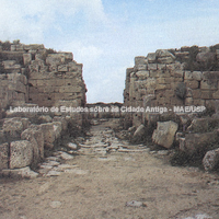
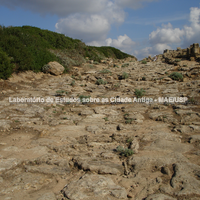
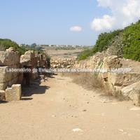
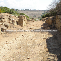
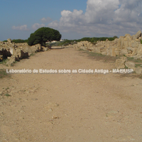
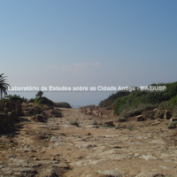
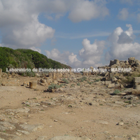
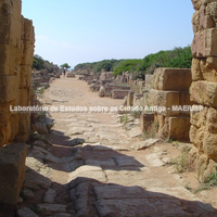
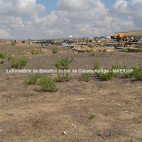
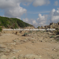
These images show parts of the street system of Selinous: stenopoi and plateiai, often connected with the gates in the walls.

Bibliography (1)
  • Labeca,; Foto Acervo Labeca

Forms of occupation of the khóra

Sacred areas: deposits, temples, shrines, sanctuaries, altars

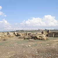
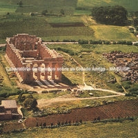
To the east of the central part of Selinous, outside the city walls, three temples were built dating from the 6th and 5th centuries BC. Of the three temples in this sector, temple F – located between temples G and E – is the oldest, dating from 550/40 BC. It is followed chronologically by temple G, begun in 530 BC, and temple E, begun in 520/10 BC. The dating of the three buildings indicates that they were contemporary, probably conceived as a single project of monumental buildings on the eastern hill.
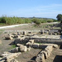
The three temples stand on the Marinella hill, which was levelled, and they are of very large proportions. In the literature these temples are treated as components of the Sanctuary of the eastern hill. However, temenos boundary walls have never been found.
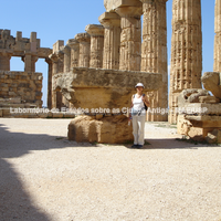
The temples were built on the same alignment as the street system of the acropolis. All are dated approximately to the 6th/5th century BC. The only one to have undergone modern reconstruction is the so-called temple E, perhaps attributed to Hera, which is the one seen standing on a visit to the archaeological site. The northernmost temple (building G), whose ruins appear in the image as a rectangle of stones, is the one attributed to Olympian Zeus (although this view is not shared by all authors; see Lilian de Angelo Laky's Master's dissertation).
The eastern hill was an extramural area directly related to the emporic function – stimulated by the river Cottone and the harbour at its mouth – and its sanctuaries are interpreted in close connection with the character of the zone (Coarelli; Torelli, 1984: 81). Besides housing the east harbour, the river Cottone was one of the routes used by those coming from or going to the north of the khóra, and thus provided communication between the interior and the area of the sanctuaries and the harbour (Laky, 2013: 119). The temples of the eastern hill lay at the level of the agora, between the acropolis zone and that of Manuzza, both west of the hill. The eastern hill area was thus directly related to the area between Manuzza and the acropolis to the west, and to the east harbour area on the river Cottone. The zone had a direct outlet to the sea via the river, and an entrance and exit to the interior by way of the river and the sea. On the city plan, the position of the temples on the hill in relation to the other structures of the city shows that they were the northernmost sanctuaries of Selinous, sanctuaries with monumental peripteral temples (surrounded by columns). The Olympieion or temple G, mentioned above, the northernmost temple of the city, is the one closest to the interior and to the northern line of houses extending from the acropolis (Laky, 2013: 120).
The appropriation of the eastern hill area and its use as a sacred site is as old as the other oldest sacred areas of the city (temple C and the sanctuary of Demeter Malophoros), as indicated by a first building phase of temple E (E1) at the beginning of the 7th century BC. Thus we also see at Selinous the function of extra-urban sanctuaries in sanctioning the capture of territory by the colonists. The distribution of the peripheral sacred areas marked out the territory appropriated by the Greeks, separating civic space from the space outside the city (Parise Presicce, 1984: 59).
The images selected here show the eastern hill in various ways: in its general setting on the plan of Selinous, in an aerial view, and in a view of temple E alone.

Bibliography (9)
  • Borgia, E.; Messineo, G.; Ancient Sicily.
  • Mertens, D.; Città e monumenti dei Greci d’Occidente.
  • Labeca,; Foto Acervo Labeca
  • Hellmann, M.; L’ Architecture Grecque. 2. Architecture religieuse et funéraire.
  • Presicce, C. P.; Nuovo Santuario periferico di Selinunte
  • Laky, L. A.; Olímpia e os Olimpieia: a origem e difusão do culto de Zeus Olímpio na Grécia dos séculos VI e V a.C.
  • Coarelli, F.; Torelli, M.; Sicilia - Guide Archeologiche Laterza.
  • Carratelli, G. P.; Sikanie: Storia e civiltà della Sicilia greca.
  • Carratelli, G. P. (ed.); The Greek world: art and civilization in Magna Graecia and Sicily.

To the west of the most densely populated core, on the other side of the river Selinos (modern Modione), within easy walking distance there and back in a day, another sacred complex of Selinous was established. This sacred area was set on a sandy dune and had a distinctive topographical projection towards the zone of Punic expansion, favouring the creation of an "international" sanctuary not foreign to the Phoenician-Punic peoples of the far west of the island. It is also known that the area was already frequented by the Elymians (a non-Greek people living in western Sicily) before the arrival of the Greeks (Veronese, 2006: 506).
Traces of open-air cults can be observed precisely in three separate parts of the Gaggera hill (Urquhart, 2010: 219). The first lies beneath the buildings of the sanctuary of Demeter Malophoros and attests intense use of the area, with activities concentrated especially around the "primitive altar", set on virgin soil, with intense signs of burning and associated cult material. Among the remains are pottery fragments of a Protocorinthian krater (640–625 BC), pots – some intact – (640–580 BC), votive tablets and miniatures, small animal figures, ornamental objects and fragments of an offering (Urquhart, 2010: 220). In the other two areas – also places where temples would later be built (temple M and the Heraion) – there are no physical structures in the levels beneath the sanctuaries, but pottery fragments were found there. In the area of the future Heraion the pottery consists exclusively of kotylai (drinking cups) of the end of the 7th century BC. Associated with them were numerous fragments of metal and terracotta figurines, charred wood and bones, interpreted as evidence of local occupation characterised by ritual banquets and sacrifices in a period before the construction of the sacred buildings (Pompeo, 1999: 50-51 apud Urquhart, 2010:220-221). On the implications of the dating and location of these finds, regarded as devices of territorialisation and a political programme, see Christiane Teodoro Custodio's Master's dissertation (2012).
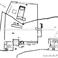
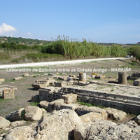
The most visible sanctuary, or at least the most excavated and best known today, is that of Demeter Malophoros. This sanctuary was established on an older, pre-Greek place of worship. The whole temenos was enclosed by a wall, and a simpler cult structure – a megaron – was built at the beginning of the 6th century BC. Approximately between 560 and 550 BC this megaron was overlaid by a larger and more monumental temple. In the 5th century BC a monumental entrance to the precinct of Demeter, a propylon, was also built, and beside it a cult precinct of Hekate Propylaia, protector of gateways.
Outside the sanctuary of Demeter Malophoros another cult precinct was established, dedicated to Zeus Meilichios, whose deposits and altar date from the end of the 7th century BC. The sacred building dates from the first quarter of the 6th century BC. A phase of monumentalisation of the sacred area is attested from the 5th century BC, and its destruction dates from the second half of the 4th century BC (Coarelli; Torelli, 1984: 101-102; Veronese, 2006: 527). The particular character of the temenos, from both the cult and the architectural point of view, reflects the constant interaction between the Greek, Phoenician-Punic and Elymian worlds (Veronese, 2006: 528).
A little further south there is yet another sanctuary, dedicated to Hera. In this last space the so-called Triolo building was excavated.
North of the sanctuary of Demeter, the structures of another temple, called temple M in the literature, also monumental in character, have likewise been excavated. Nearby there was a monumental fountain.
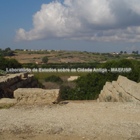
From the acropolis all these sacred buildings could be seen, as their ruins can be seen today.
As we saw earlier, the eastern hill – compared with the sanctuaries of the western Gaggera hill – is characterised by monumental temples and by cults of a certainly Greek type, whose symbolic charge (the language of cult and architecture) was addressed to and shared only by the Greek world, unlike the Gaggera hill, whose sanctuaries were oriented towards both a Greek and a non-Greek reality (Veronese, 2006: 507).
On the plan of the city of Selinous this whole sacred area, now called the Gaggera hill, can be clearly seen.

Bibliography (9)
  • Borgia, E.; Messineo, G.; Ancient Sicily.
  • Urquhart, L. M.; Colonial Religion and Indigenous Society in the Archaic West Mediterranean c. 750 - 400 BC.
  • Labeca,; Foto Acervo Labeca
  • Custodio, C. T.; Khóra e ásty nas pólis grgas do Ocidente: o caso de Selinonte
  • Hellmann, M.; L’ Architecture Grecque. 2. Architecture religieuse et funéraire.
  • Veronese, F.; Lo spazio e la dimensione del sacro: santuari greci e territorio nella Sicilia arcaica
  • Coarelli, F.; Torelli, M.; Sicilia - Guide Archeologiche Laterza.
  • Marconi, C.; Temple Decoration and Cultural Identity in the Archaic Greek World: The Metopes of Selinus.
  • Carratelli, G. P. (ed.); The Greek world: art and civilization in Magna Graecia and Sicily.

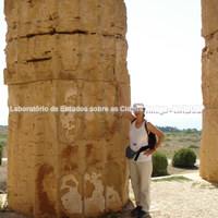
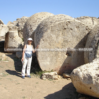
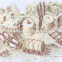
To construct a building of gigantic dimensions requires labour, resources and time. It also requires leadership to bring a city to accept the challenge. And it is indispensable to believe in a purpose for the existence of such buildings. At Selinous, not a few buildings – temples – were constructed on a monumental scale. Part of the visual discourse of autocratic, tyrannical power? Competition with neighbouring poleis? Construction of a specific identity for the city?

In any case, note in these images the gigantic dimensions of the column drums and their capitals.

Bibliography (1)
  • Labeca,; Foto Acervo Labeca

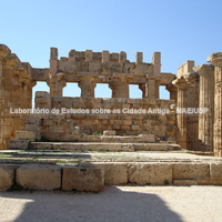
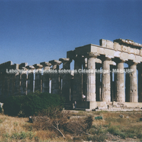
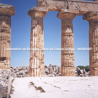
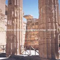
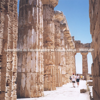
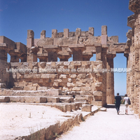
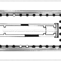
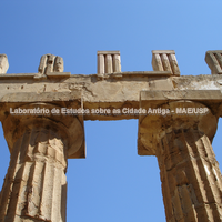
Temple E, rebuilt in 1958. The southernmost of the three buildings on the eastern hill and the oldest, it was Doric with 6 x 15 columns, and the plan of 25.33 x 67.82 metres belongs to the temple (E3) of 460/50 BC, although it had a predecessor in the 7th century (E1) and in the 6th century BC (E2) (Coarelli; Torelli, 1984: 81-83; Veronese, 2006: 508-509). The building is known for the four metopes recovered from the pronaos, one of the images depicting the sacred marriage of Zeus and Hera. Temple E is attributed to Hera on the basis of an inscription of dedication to the goddess (IG XIV, 271) and of the extra-urban location of the sanctuary near the harbour, which has parallels in the ancient sanctuaries of Hera at Poseidonia and Croton (Coarelli; Torelli, 1984: 88; Veronese, 2006: 505 and 508).

Bibliography (7)
  • Borgia, E.; Messineo, G.; Ancient Sicily.
  • Labeca,; Foto Acervo Labeca
  • Hellmann, M.; L’ Architecture Grecque. 2. Architecture religieuse et funéraire.
  • Veronese, F.; Lo spazio e la dimensione del sacro: santuari greci e territorio nella Sicilia arcaica
  • Coarelli, F.; Torelli, M.; Sicilia - Guide Archeologiche Laterza.
  • Carratelli, G. P. (ed.); The Greek world: art and civilization in Magna Graecia and Sicily.
  • Minà, P.; Urbanistica e architettura nella Sicília greca.

Temple F, the smallest of the three buildings on the eastern hill, measures 24.43 x 61.83 metres; it had 6 x 14 columns and a long cella with a pronaos (antechamber) and adyton (sacred room at the back of the cella). The discovery of a statuette of Athena between this temple and temple E was considered evidence that the building was dedicated to the goddess (Bejor, 1977: 452). However, the fragmentary metope of temple F depicting the fight between Dionysus and a Titan, and the importance and antiquity of the cult of the god in the Megarian milieu, have led to the attribution of temple F to that god. At Megara Nisaea, the founding city of Selinous, Dionysus held a prominent place with the epithet Patroos and with a nocturnal cult in which he was called Nyktelios (Bejor, 1977: 453; Coarelli; Torelli, 1984:84).

Bibliography (5)
  • Mertens, D.; Città e monumenti dei Greci d’Occidente.
  • Veronese, F.; Lo spazio e la dimensione del sacro: santuari greci e territorio nella Sicilia arcaica
  • Bejor, G.; Problemi di Localizzazione di culti a Selinunte
  • Coarelli, F.; Torelli, M.; Sicilia - Guide Archeologiche Laterza.
  • Minà, P.; Urbanistica e architettura nella Sicília greca.

The largest building on the eastern hill, temple G was the largest Doric temple in the Greek world until the construction of the Olympieion at Akragas, the neighbouring polis to the east of Selinous, at the beginning of the 5th century BC (480 BC). Construction of temple G began in the second half of the 6th century BC, in 530 BC, and it was not finished before the destruction of Selinous by the Carthaginians in 409 BC. Temple G had an elongated rectangular plan with two estimated dimensions, one of 49.97 x 109.12 metres and the other of 54.05 x 113.34 metres, and the peristasis (the colonnade surrounding the Greek temple) consisted of 8 x 17 columns (Coarelli; Torelli, 1984: 85; Mertens, 2006: 232; Veronese, 2006: 514). It was also pseudodipteral (there was a space between the cella and the peristasis that could accommodate a second colonnade), an architectural feature of the monumental dipteral temples (with two colonnades surrounding the temple) of Ionia, which in Sicily was used in pseudodipteral form in temples reaching dimensions of 50 x 110 m.
The cella had a deep prostyle, tetrastyle pronaos, therefore with 4 x 2 columns, and measured c. 17 x 20 metres internally. The naos was divided into three aisles by two rows of 10 columns ending in an inner naiskos – the adyton – intended to house the cult statue and considered a typical element of the sacred architecture of Sicily and of Selinous in particular. The size of the columns, too small to support a roof, and the discovery of a carefully worked drainage channel in the floor of the cella led to the reconstruction of the naos as a sekos (not covered by a roof). This is one of the main features of the temple of Apollo Didymaios at Didyma, conceived as a sekos with a naiskos similar to that of temple G, which again finds significant parallels in the great dipteral temples of the East (Coarelli; Torelli, 1984: 86; Mertens, 2006: 233-234; Veronese, 2006: 514). The distyle in antis opisthodomos did not communicate with the cella and probably served to keep the temple treasury. Inside the cella small side staircases were found, which probably gave access to the roof and roof space (Coarelli; Torelli, 1984: 86; Veronese, 2006: 514).
The columns make up most of the architectural finds from the temple and give us a sense of its monumentality. Like all the architectural and sculptural elements found, the columns were made of limestone. Those of the peristasis reached 16.27 metres in height and had a circumference of 10.70 metres. The diameter at the base of the column measures 3.41 metres, at the top 1.41 metres, and the capital has an abacus of 16 m² (Bianco; Sammartano, 2004: 89; Coarelli; Torelli, 1984: 85; Di Giovanni, 1991: 56; Veronese, 2006: 514).

As with the other temples of the eastern hill, there is controversy over the deity to which temple G was attributed. Specialists now accept Olympian Zeus as the deity worshipped in the temple, but for a long time some supposed it to be Apollo. The doubt between Zeus and Apollo was based on the information provided by an inscribed stone block, the so-called Selinous Tablet, found at the entrance to the adyton of temple G. The inscription refers to a deposit of a sum of gold in the temple of Apollo and gives repeated thanks to Zeus. Greek temples functioned as civic archives and as places to keep the money of the polis, sums that belonged to the treasury of the god and had his sanction. Since it would make no sense for the inscription to be placed in the temple of Apollo itself, specialists took the thanks to Zeus as evidence that the inscription had been placed in the temple of that deity. The architectural similarities between temple G and the temple of Olympian Zeus at Akragas have recently been taken as strong evidence that temple G was dedicated to Olympian Zeus (Laky, 2013: 248-250).
The temples dedicated to Olympian Zeus in the Greek world, built in the poleis in the 6th and 5th centuries BC, are precisely those buildings which in the Greek West and in mainland Greece resulted from the spread of colossal dimensions, unusual for Greek temples, originating with the tyrannies of Ionia, through competition between tyrants and Greek poleis. Moreover, in these two regions the tyrants intended to incorporate such proportions into the cult of Olympian Zeus – as had happened nowhere else in the Greek world – to legitimise and match their authority with the figure of the god, the king of gods and men (Laky, 2013: 297).

Bibliography (8)
  • Mertens, D.; Città e monumenti dei Greci d’Occidente.
  • Labeca,; Foto Acervo Labeca
  • Veronese, F.; Lo spazio e la dimensione del sacro: santuari greci e territorio nella Sicilia arcaica
  • Laky, L. A.; Olímpia e os Olimpieia: a origem e difusão do culto de Zeus Olímpio na Grécia dos séculos VI e V a.C.
  • Samartano, A.; Bianco, L.; Sèlinonte
  • Giovanni, G. d.; Selinunte. Itinerario Archeologico
  • Coarelli, F.; Torelli, M.; Sicilia - Guide Archeologiche Laterza.
  • Minà, P.; Urbanistica e architettura nella Sicília greca.

Temple M is located in the khóra of Selinous, on the Gaggera hill, north of the Sanctuary of Demeter Malophoros. Its remains are scant, but it can be said to have enjoyed a privileged view, since it stood on a high part of the hill, visibly set in the landscape as seen from the acropolis. Its alignment corresponds to the Manuzza street alignment, which dates from the second half of the 6th century BC. Temple M was excavated in the 1950s and its altar was also uncovered.

Bibliography (1)
  • Hellmann, M.; L’ Architecture Grecque. 2. Architecture religieuse et funéraire.

Building techniques

Architectural details

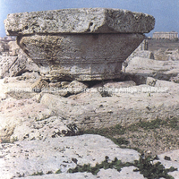
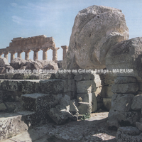
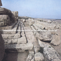
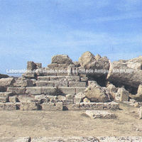
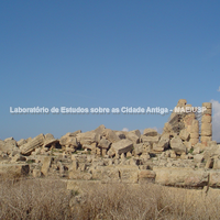
The architectural details shown here help us understand how the Greeks constructed their buildings. Although houses might have only the base of their walls made of stone, public buildings, religious or civic, were generally built of carved stone and sometimes had details added – such as metopes and other architectural sculptures – in clay.
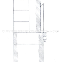
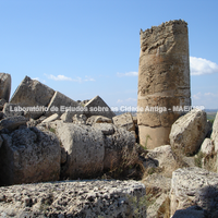
In these images we can see how columns were assembled from drums and then fluted; how the architrave rests on the capitals and the triglyphs are placed on it; how the corners of temples were structured; how the columns rest on the stylobate and how it was reached by steps. There are also images of stones laid on one another in retaining walls or buildings, and images of the placing of door thresholds. It is also essential to note the effect of time on the buildings.

Bibliography (4)
  • Mertens, D.; Città e monumenti dei Greci d’Occidente.
  • Labeca,; Foto Acervo Labeca
  • Carratelli, G. P.; Sikanie: Storia e civiltà della Sicilia greca.
  • Minà, P.; Urbanistica e architettura nella Sicília greca.

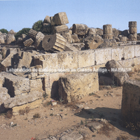
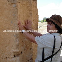
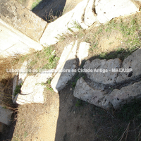
In these fallen temple columns we can see how columns were assembled from drums cut in the stone.

Note also, on the stone on the ground, the wear caused by the opening and closing of a door that no longer exists.

Bibliography (2)
  • Labeca,; Foto Acervo Labeca
  • Calìa, S.; Selinunte. La città antica - V séc. a.C.

Forms of occupation of the khóra

Water management: channels, cisterns, wells.

Traces of water channels for drainage always appear in Greek cities, whether in the khóra or in the ásty. They generally follow the streets or the walls of buildings.

Bibliography (1)
  • Labeca,; Foto Acervo Labeca

Forms of occupation of the ásty

Residential areas

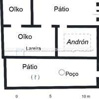
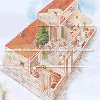
In the agora of Selinous houses were found aligned along the east side. Here we can see the plans of these Archaic and Classical dwellings

Bibliography (1)
  • Mertens, D.; Città e monumenti dei Greci d’Occidente.

Relationship between ásty and khóra

Structures between ásty and khóra: walls, necropoleis, sanctuaries.

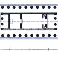
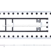
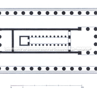
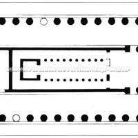
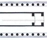
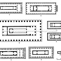
Comparative plans of temples at Selinous. Note the reconstruction of temple M made from the plan recovered in the excavations.
Note the proportions of the different temples.
It is interesting to observe the monumentalisation of the temples, which was often related to tyrannical power.

Bibliography (5)
  • Mertens, D.; Città e monumenti dei Greci d’Occidente.
  • Hellmann, M.; L’ Architecture Grecque. 2. Architecture religieuse et funéraire.
  • Veronese, F.; Lo spazio e la dimensione del sacro: santuari greci e territorio nella Sicilia arcaica
  • Coarelli, F.; Torelli, M.; Sicilia - Guide Archeologiche Laterza.
  • Minà, P.; Urbanistica e architettura nella Sicília greca.

Reconstructions

Reconstructions

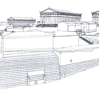
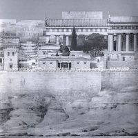
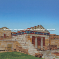
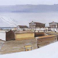
There are many ways of dealing with the material evidence recovered in archaeological work on antiquity. One of them is reconstruction. From one or two courses of stone and a few remains of columns, we can recover the structure of a temple or building, drawing its original plan and its configuration in various dimensions. We can also make models.

These images clearly show what it has been possible to do with the remains recovered from the excavations at Selinous, so as to add to our knowledge of the life of the Greeks in antiquity.

Bibliography (4)
  • Borgia, E.; Messineo, G.; Ancient Sicily.
  • Mertens, D.; Città e monumenti dei Greci d’Occidente.
  • Calìa, S.; Selinunte. La città antica - V séc. a.C.
  • Minà, P.; Urbanistica e architettura nella Sicília greca.

Research methodology

Archaeology of space

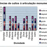
This group of images shows how graphs can be produced using GIS methodology in building knowledge about space in antiquity.

Bibliography (1)
  • Veronese, F.; Lo spazio e la dimensione del sacro: santuari greci e territorio nella Sicilia arcaica

Relationship between ásty and khóra

Roads, streets, gates in the walls

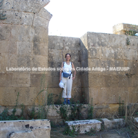
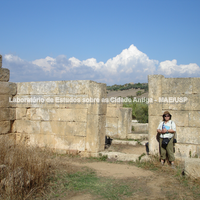
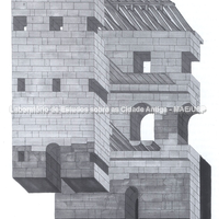
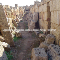
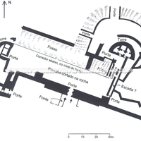
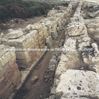
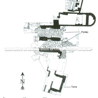
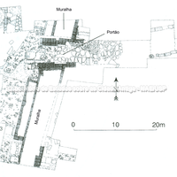
Walls. In these photos and plans we see the walls of Selinous. But it is important to remember that remains of the Archaic and Classical periods have been found only on the east side of the city, facing the Greek city of Akragas, with which Selinous competed. This is still a controversial question in studies of this city. Only later, including the period when the city was under Punic rule from the beginning of the 4th century BC, did the walls surround the whole central part containing the ásty (see Christiane Teodoro Custodio's Master's dissertation)

In these images we can clearly see gates in the walls opening towards the Sanctuary of Demeter Malophoros, on the Gaggera hill to the west, building techniques of the walls, and streets ending at gates in the walls.

Bibliography (5)
  • Labeca,; Foto Acervo Labeca
  • Frederiksen, R.; Greek City Walls of the Archaic Period, 900-480 BC (Oxford Monographs on Classical Archaeology)
  • Custodio, C. T.; Khóra e ásty nas pólis grgas do Ocidente: o caso de Selinonte
  • Carratelli, G. P.; Sikanie: Storia e civiltà della Sicilia greca.
  • Holloway, R. R.; The Archaeology of Ancient Sicily.