Agrigento

Sicily (South Coast)

Agrigento is a secondary colony founded by Gela in 582 BC, with the participation of a contingent from Rhodes. It lies on the south coast of Sicily and was founded to extend Gela's sphere of influence in the region. It was destroyed by the Carthaginians in 406 and was (eventually) "refounded" in the Timoleontic period, from 344 BC. The settlement lay 3 km from the sea between two hills – the Girgenti to the west and the Rupe Atenea to the east – connected by a narrow passage, and a plain extending southwards and ending in a steep slope covered with temples.
At the time of its foundation the Greeks called this apoikia Akragas; under Roman rule it became Agrigentum; under Arab rule its name was Kerkent and under Norman rule Girgenti, a name that lasted well into the 20th century. Finally, in Mussolini's time, in the first half of the 20th century, the Roman name was adopted: Agrigento. And so it remains today.
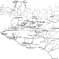
Agrigento stands out among the Greek apoikiai of Sicily for its many very well-preserved temples. This sometimes leads the unwary to believe that the city consisted only of the core where these larger buildings stood. However, Agrigento's area of expansion into the interior of the island was already extensive in the Archaic period. See, for example, the settlements at Vassallaggi and Monte Saraceno di Ravanusa.

Forms of occupation of the khóra

Sacred areas: deposits, temples, shrines, sanctuaries, altars

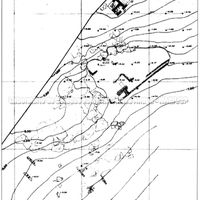
Marianopoli. Monte Castellazzo di Marianopoli. This site has walls, an acropolis and a sacred area. An indigenous settlement, like Monte Saraceno di Ravanusa and Vassallaggi, under the Greek influence of Akragas. Today it lies in the province of Palermo.
Bibliography (1)
  • Veronese, F.; Lo spazio e la dimensione del sacro: santuari greci e territorio nella Sicilia arcaica
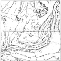
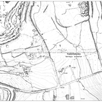
Monte Saraceno di Ravanusa is a site with an indigenous settlement dating from before the arrival of the Greeks at Akragas. On its acropolis a Greek temple dedicated to chthonic deities and dated to the 6th century BC was found. In its building techniques the temple is very close to temples B and C at Himera. Its structure is of the 'oikos' type. It is considered an extra-urban temple in relation to Akragas (see Veronese, op. cit., for bibliography).
Also at Monte Saraceno di Ravanusa a hestiatorion was found that was in use between the middle of the 6th and the end of the 5th century BC. The remains at the site point to animal sacrifice.

Bibliography (1)
  • Veronese, F.; Lo spazio e la dimensione del sacro: santuari greci e territorio nella Sicilia arcaica

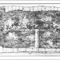
Sanctuary of Demeter and Kore (temple) beneath the Church of San Biagio on the Hill of Athena (Rupe Atenea). In the 6th century BC a small sanctuary dedicated to Demeter and Kore was built at this site, right over natural springs. There is material evidence that even earlier this was a place of worship, perhaps of indigenous origin. In the 5th century the temple of Demeter and Kore was built, incorporating this small sanctuary, and finally, in the Christian period, it was covered by a church dedicated to San Biagio. The temple of Demeter and Kore, in this position on the east side of the Rupe Atenea, forms a 'pendant' to the temple of Athena on the Acropolis, on the west side of the Rupe Atenea.

Bibliography (5)
  • Labeca,; Foto Acervo Labeca
  • Veronese, F.; Lo spazio e la dimensione del sacro: santuari greci e territorio nella Sicilia arcaica
  • Florenzano, M. B. B.; Relatório científico de viagem ao exterior
  • Coarelli, F.; Torelli, M.; Sicilia - Guide Archeologiche Laterza.
  • Carratelli, G. P.; Sikanie: Storia e civiltà della Sicilia greca.

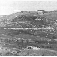
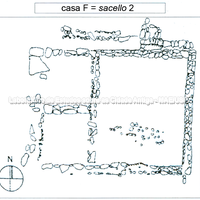
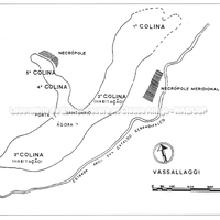
Vassallaggi. This is an indigenous centre under the influence of Akragas, set on a platform formed by a system of five small rocky hills. This arrangement can be clearly seen in the drawing. A sacred area consisting of a temenos, a small shrine in antis and an altar was found there. The finds point to the cult of a chthonic deity. The date is 6th/5th century BC.

Bibliography (1)
  • Veronese, F.; Lo spazio e la dimensione del sacro: santuari greci e territorio nella Sicilia arcaica
Forms of occupation of the ásty

Work areas: workshops

Production area.

Bibliography (1)
  • Benevolo, L.; História da Cidade.

Forms of occupation of the ásty

Sacred areas: deposits, temples, shrines, sanctuaries, altars

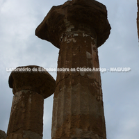
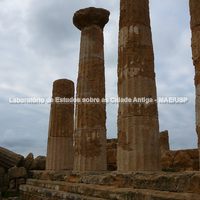
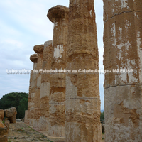
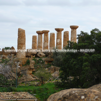
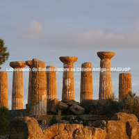
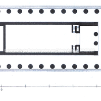
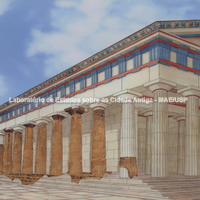
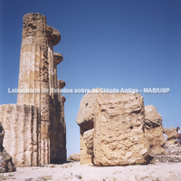
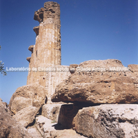
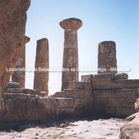
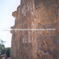
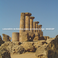
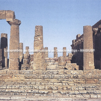
East of the monumental temple of Zeus, another temple, attributed in modern times to the cult of Heracles (temple A). The attribution is uncertain and is related to the text of Cicero (Verr., II, 4, 94), which mentions the existence of a temple in the city dedicated to this deity. It dates from the end of the 6th century BC, and archaeology points to its use until the 4th century AD (Veronese, 2006, p. 457).

Bibliography (7)
  • Borgia, E.; Messineo, G.; Ancient Sicily.
  • Mertens, D.; Città e monumenti dei Greci d’Occidente.
  • Labeca,; Foto Acervo Labeca
  • Veronese, F.; Lo spazio e la dimensione del sacro: santuari greci e territorio nella Sicilia arcaica
  • Florenzano, M. B. B.; Relatório científico de viagem ao exterior
  • Coarelli, F.; Torelli, M.; Sicilia - Guide Archeologiche Laterza.
  • Minà, P.; Urbanistica e architettura nella Sicília greca.

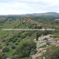
Temple of Athena. Church of Santa Maria dei Greci built over the ancient temple of Athena (480–460 BC), situated on the highest part of the Rupe Atenea (Hill of Athena).

Bibliography (3)
  • Labeca,; Foto Acervo Labeca
  • Florenzano, M. B. B.; Relatório científico de viagem ao exterior
  • Coarelli, F.; Torelli, M.; Sicilia - Guide Archeologiche Laterza.

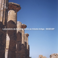
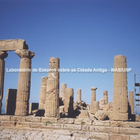
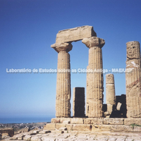
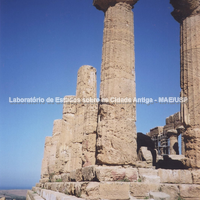
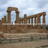
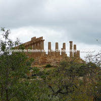
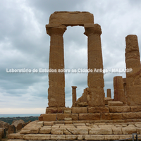
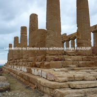
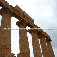
Temple of Hera. The temple of Hera is known by the Latin name of the temple of Juno Lacinia. But, as with the other temples, the attribution to this deity is fanciful and goes back to the Renaissance. It originally dates from the mid-5th century, and its remains show the fire of 406 BC, during the invasion and destruction by the Carthaginians.

Bibliography (7)
  • Griffo, P.; Akragas. Agrigento. Storia, topografia, i monumenti, gli scavi.
  • Borgia, E.; Messineo, G.; Ancient Sicily.
  • Mertens, D.; Città e monumenti dei Greci d’Occidente.
  • Labeca,; Foto Acervo Labeca
  • Florenzano, M. B. B.; Relatório científico de viagem ao exterior
  • Carratelli, G. P. (ed.); The Greek world: art and civilization in Magna Graecia and Sicily.
  • Minà, P.; Urbanistica e architettura nella Sicília greca.

Temple of Hephaestus, dated to the second half of the 5th century BC and located further north, opposite the area of the sanctuary of the chthonic deities, on the north side of the Kolymbethra. This temple was built over an Archaic sanctuary of the 6th century BC.

Bibliography (5)
  • Mertens, D.; Città e monumenti dei Greci d’Occidente.
  • Veronese, F.; Lo spazio e la dimensione del sacro: santuari greci e territorio nella Sicilia arcaica
  • Coarelli, F.; Torelli, M.; Sicilia - Guide Archeologiche Laterza.
  • Carratelli, G. P.; Sikanie: Storia e civiltà della Sicilia greca.
  • Minà, P.; Urbanistica e architettura nella Sicília greca.

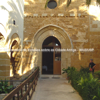
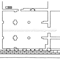
Beneath a church of a medieval monastery, on a rise known as the poggio San Nicola (today a National Museum), a sacred area was found, with a temenos and a small two-part shrine dedicated to Demeter and Kore. It was in use between the 6th century BC and the 6th century AD. Around it there are remains of other buildings, probably already dismantled in the Hellenistic period (Veronese, p.471).

Bibliography (1)
  • Veronese, F.; Lo spazio e la dimensione del sacro: santuari greci e territorio nella Sicilia arcaica
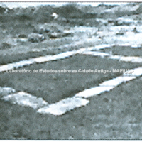
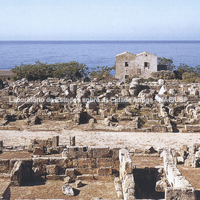
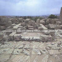
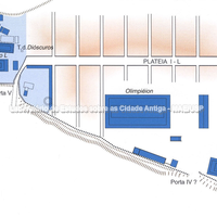
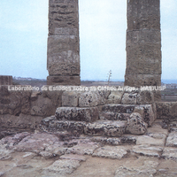
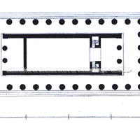
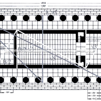
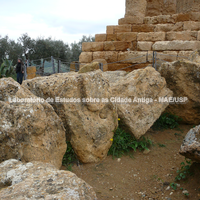
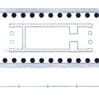
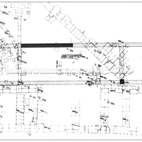
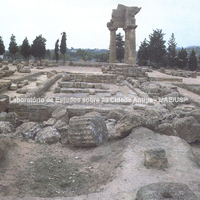
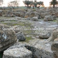
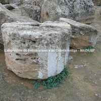
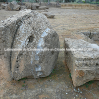
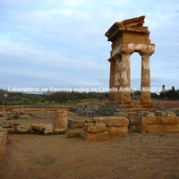
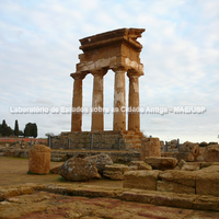
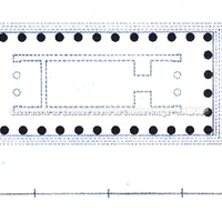
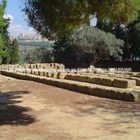
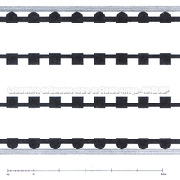
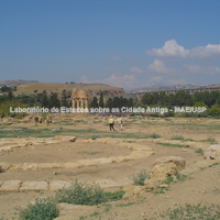
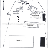
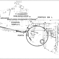
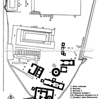
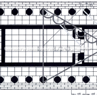
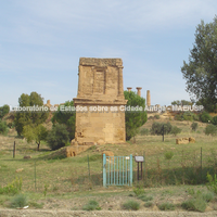
The temple of the Dioscuri is associated with the area of the great sanctuary of the chthonic deities. This temple was rebuilt at the beginning of the 19th century with material that was scattered over the site, from various periods and different buildings. We do not even know whether it was dedicated to the Dioscuri, as it is known today. What we know for certain is its stylobate, whose plan is shown below.

Bibliography (5)
  • Borgia, E.; Messineo, G.; Ancient Sicily.
  • Mertens, D.; Città e monumenti dei Greci d’Occidente.
  • Labeca,; Foto Acervo Labeca
  • Florenzano, M. B. B.; Relatório científico de viagem ao exterior
  • Minà, P.; Urbanistica e architettura nella Sicília greca.

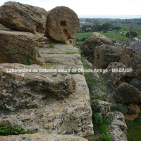
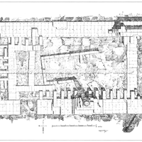
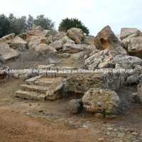
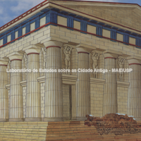
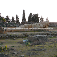
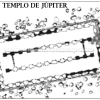
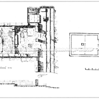
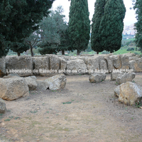
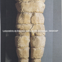
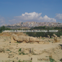
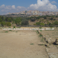
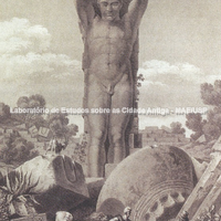
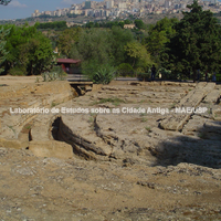
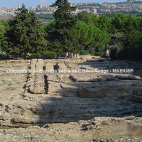
Construction of the temple of Olympian Zeus at Akragas began in 480 BC. Both Polybius (IX,27,6) and Diodorus (XIII,82,1-5) attribute this building to Zeus, the latter describing it. The first excavations at the site date from 1802 and 1804, and they recognised the plan of the building. The Olympieion is the largest Doric temple ever built by the Greeks. Traditionally the building is associated with the Battle of Himera in 480 BC, when construction of the temple is said to have begun as a monument to the victory of the Greeks over the Carthaginians. The dimensions of the temple are monumental: its base measured 56.3 x 112.60 metres and its foundations were between 6 and 7 metres deep. Its total height is calculated to have been approximately 20 metres. The originality of this temple lies in the placing of gigantic statues of "Telamones", male sculptures that appear to hold up the architrave with their arms. In front of the temple a gigantic altar measuring 54.5 x 17.5 metres was found. It should be said that the Olympieion formed a group with other temples on the Hill of the Temples at Akragas and that, naturally, those arriving along the coast, at the city's harbour, saw all these temples from afar, with the Olympieion standing out (Laky, 2013: 172-191).

Bibliography (11)
  • Borgia, E.; Messineo, G.; Ancient Sicily.
  • Mertens, D.; Città e monumenti dei Greci d’Occidente.
  • Labeca,; Foto Acervo Labeca
  • Benevolo, L.; História da Cidade.
  • Hellmann, M.; L’ Architecture Grecque. 1. Les principes de la construction.
  • Veronese, F.; Lo spazio e la dimensione del sacro: santuari greci e territorio nella Sicilia arcaica
  • Laky, L. A.; Olímpia e os Olimpieia: a origem e difusão do culto de Zeus Olímpio na Grécia dos séculos VI e V a.C.
  • Florenzano, M. B. B.; Relatório científico de viagem ao exterior
  • Holloway, R. R.; The Archaeology of Ancient Sicily.
  • Minà, P.; Urbanistica e architettura nella Sicília greca.
  • AA.VV.,; Urbanistica e architettura nella Sicília greca: Agrigento, Museo Archeologico Regionale 14/Novembro/2004 a 14/Maio/2005.

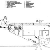
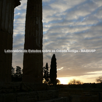
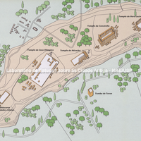
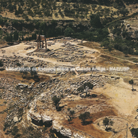
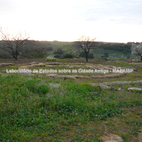
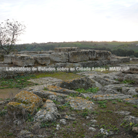
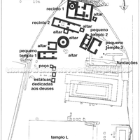
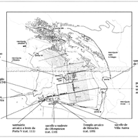
Hill of the Temples / sanctuary of the chthonic deities, temple of Demeter and Kore, temple of the Dioscuri. The Hill of the Temples, running along the south side of the ásty inside the walls, contains an enormous sacred area including monumental temples (one of which was converted into a Christian church in the 6th century AD), beginning with the so-called Temple of Hera in the east and extending to a huge sanctuary dedicated to the chthonic goddesses Demeter and Persephone in the west.
This is a very well-preserved sacred complex in the ásty and is visited by many tourists today.
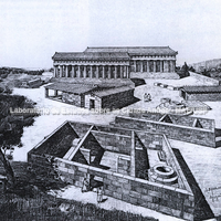
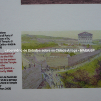
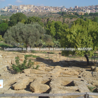
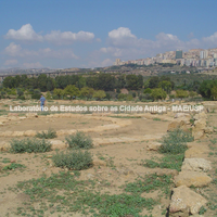
From east to west we find the temples of Hera, Concord, Heracles, Olympian Zeus, the Dioscuri and Demeter and Kore. The names were given on the basis of ancient written sources, so we are not certain of the deities worshipped in each of them. This is particularly the case of the Temples of Concord and of the Dioscuri. This whole great sacred area borders the city walls on their south side and extends from a little before gate IV to beyond gate V. This south side is the side seen from the harbour. As can be seen from the plans and other images, the city was built on a rise. Thus anyone arriving at Akragas by sea, from the harbour, could see from afar the grandeur of this row of temples. There is much to consider about the meaning of this choice by the Akragantines! Ultimately, we can say that the row of temples raised on the city's platform and richly adorned pointed to a powerful and wealthy city, an image that the Akragantines undoubtedly wanted to convey to new arrivals.
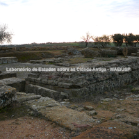
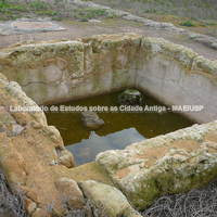
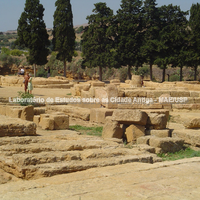
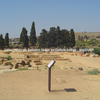
The archaeological remains, especially in the westernmost area where the temple of the Dioscuri and the sanctuary of the chthonic deities, Demeter and Kore, are located, are very confused and difficult to interpret. The temple of the Dioscuri, for example, was reconstructed in an entirely fanciful way and, as we now know, by combining material from different buildings. The whole area has numerous small buildings and altars. There are also square, waterproofed pits, and round, perforated altars, probably to receive offerings. Added to this is the fact that the chronology is also muddled. According to Coarelli (1984, p.149), the cult of the two goddesses (Demeter and Kore) was very important at Akragas, and the ritual involved two paired altars: one square and the other round with a cavity in the middle – the square one for blood offerings and the round one for depositing gifts for the two goddesses in its central cavity.

Bibliography (11)
  • Miro, E. D.; Agrigento. I. I santuari urbani. L’area sacra tra il tempio di Zeus e Porta V. 2. Figure e Tavole.
  • Giovanni, G. d.; Agrigento - La Valle dei Templi, il Museo Regionale
  • Borgia, E.; Messineo, G.; Ancient Sicily.
  • Mertens, D.; Città e monumenti dei Greci d’Occidente.
  • Labeca,; Foto Acervo Labeca
  • Hellmann, M.; L’ Architecture Grecque. 2. Architecture religieuse et funéraire.
  • Veronese, F.; Lo spazio e la dimensione del sacro: santuari greci e territorio nella Sicilia arcaica
  • Florenzano, M. B. B.; Relatório científico de viagem ao exterior
  • Coarelli, F.; Torelli, M.; Sicilia - Guide Archeologiche Laterza.
  • Carratelli, G. P.; Sikanie: Storia e civiltà della Sicilia greca.
  • Minà, P.; Urbanistica e architettura nella Sicília greca.

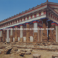
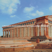
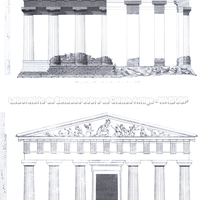
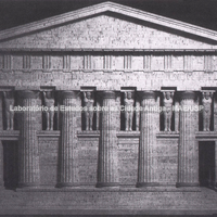
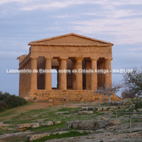
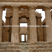
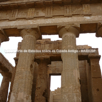
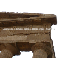
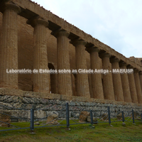
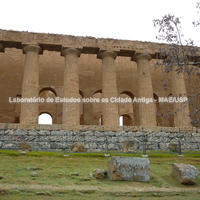
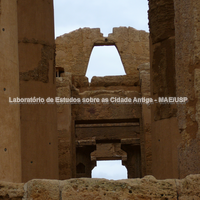
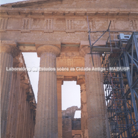
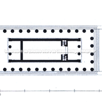
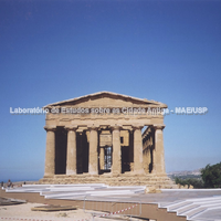
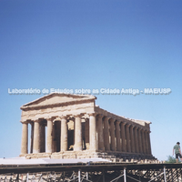
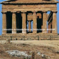
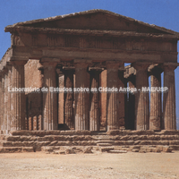
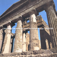
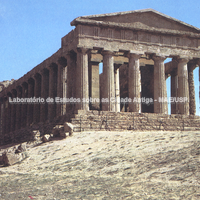
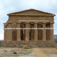
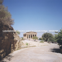
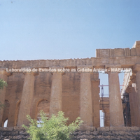
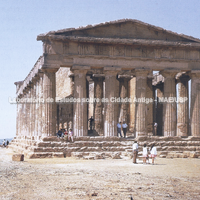
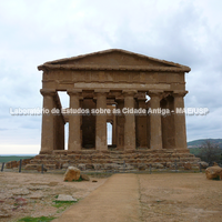
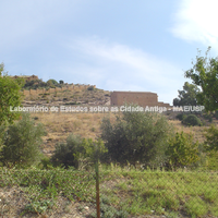
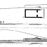
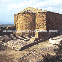
Temple of "Concord" (or temple F). This temple was built in the mid-5th century BC, and it is not known to which deity it was attributed at that time. A Roman-period dedication to Concordia was found there, hence its name. It is very well preserved, which is undoubtedly due to the fact that in the last years of the 6th century AD it was converted into a Christian church by Bishop Gregory of Agrigento. At that time it was dedicated to St Peter and St Paul, and later to St Gregory.

Bibliography (8)
  • Griffo, P.; Akragas. Agrigento. Storia, topografia, i monumenti, gli scavi.
  • Mertens, D.; Città e monumenti dei Greci d’Occidente.
  • Labeca,; Foto Acervo Labeca
  • Florenzano, M. B. B.; Relatório científico de viagem ao exterior
  • Carratelli, G. P.; Sikanie: Storia e civiltà della Sicilia greca.
  • Holloway, R. R.; The Archaeology of Ancient Sicily.
  • Carratelli, G. P. (ed.); The Greek world: art and civilization in Magna Graecia and Sicily.
  • Minà, P.; Urbanistica e architettura nella Sicília greca.

Reconstructions

Reconstructions

Images of various reconstructions.

Bibliography (8)
  • Giovanni, G. d.; Agrigento - La Valle dei Templi, il Museo Regionale
  • Borgia, E.; Messineo, G.; Ancient Sicily.
  • Mertens, D.; Città e monumenti dei Greci d’Occidente.
  • Labeca,; Foto Acervo Labeca
  • Holloway, R. R.; The Archaeology of Ancient Sicily.
  • Carratelli, G. P. (ed.); The Greek world: art and civilization in Magna Graecia and Sicily.
  • Minà, P.; Urbanistica e architettura nella Sicília greca.
  • AA.VV.,; Urbanistica e architettura nella Sicília greca: Agrigento, Museo Archeologico Regionale 14/Novembro/2004 a 14/Maio/2005.

Research methodology

Archaeology of space

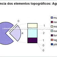
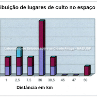
F. Veronese, who studied the sacred areas of Sicily in the Archaic period and in the long term, used both GIS (georeferencing) and statistical plotting of the data.

Bibliography (1)
  • Veronese, F.; Lo spazio e la dimensione del sacro: santuari greci e territorio nella Sicilia arcaica

Forms of occupation of the ásty

Urban grid: acropolis, block, agora, plateiai, stenopoi, orientation

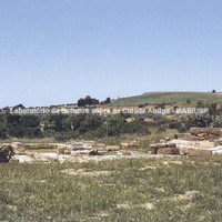
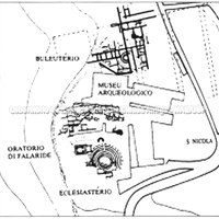
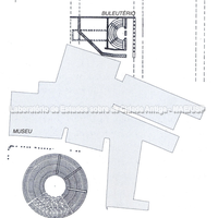
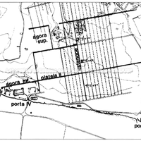
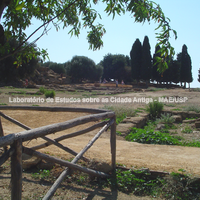
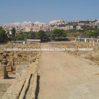
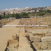
Agoras and adjacent buildings (bouleuterion and ekklesiasterion). This part of the ásty, occupied in the Archaic period by sanctuaries, contained two important administrative public buildings: the bouleuterion, the meeting place of the council (Boulé), and the ekklesiasterion, the place of the citizens' assemblies. The chronology of the ekklesiasterion is still debated, while the bouleuterion is more securely dated to the 4th or 3rd century. In any case this would have been an important civic area from the 6th century, since a monumental stoa, also securely dated to the end of the 6th century BC, was excavated in a space adjoining these structures. Today this agora is called the upper agora. The lower agora, laid out on two terraces, was located north-east of the Olympieion, between plateia II and plateia III. It was laid out at the same time as the street plan. Little remains of this ancient square, but its important position in the urban grid (albeit off-centre) should be noted, directly related to gates V and IV. It is also worth noting that the monumental sanctuary of Olympian Zeus lay within it and that it was bounded to the south by the temple of Heracles. Note that it extends along plateia II, the widest of all, which runs through the whole city, and that it is set in the context

Bibliography (4)
  • Mertens, D.; Città e monumenti dei Greci d’Occidente.
  • Hellmann, M.; L’ Architecture Grecque. 2. Architecture religieuse et funéraire.
  • Veronese, F.; Lo spazio e la dimensione del sacro: santuari greci e territorio nella Sicilia arcaica
  • Florenzano, M. B. B.; Relatório científico de viagem ao exterior

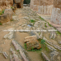
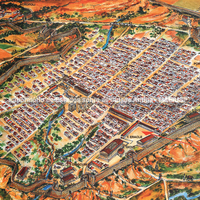
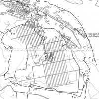
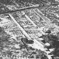
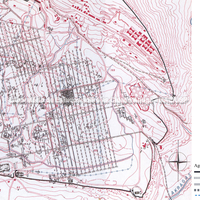
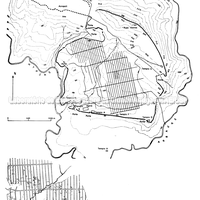
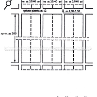
Roads and routes. The urban settlement of Akragas was organised around six main east–west axes (plateiai) 7 metres wide and a network of smaller streets (stenopoi) dating from the 6th century BC. The crossing of these streets produced blocks 35 metres wide by about 300 metres long. There were two sectors, one in the north-west and the other occupying the central part towards the south. The agora lay at the junction of these two sectors, at a height of 125 metres above sea level. The differences between the two sectors relate to orientation and probably result from the sectors belonging to different periods.

Bibliography (7)
  • Giovanni, G. d.; Agrigento - La Valle dei Templi, il Museo Regionale
  • Mertens, D.; Città e monumenti dei Greci d’Occidente.
  • Labeca,; Foto Acervo Labeca
  • Hellmann, M.; L’ Architecture Grecque. 2. Architecture religieuse et funéraire.
  • Veronese, F.; Lo spazio e la dimensione del sacro: santuari greci e territorio nella Sicilia arcaica
  • Florenzano, M. B. B.; Relatório científico de viagem ao exterior
  • Minà, P.; Urbanistica e architettura nella Sicília greca.

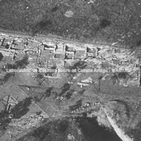
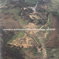
Aerial images of the ásty showing the main urban structures.

Bibliography (4)
  • Ward-Perkins, J. B.; Cities of Ancient Greece and Italy: Planning in the Classical Antiquity.
  • Benevolo, L.; História da Cidade.
  • Miro, E. D. (ed.); Braccesi, L. (ed.); Bonacasa, N. (ed.); La Sicilia dei due Dionisî.
  • Carratelli, G. P.; Sikanie: Storia e civiltà della Sicilia greca.

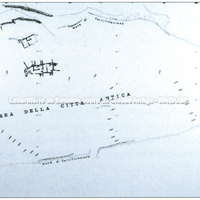
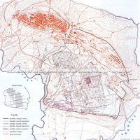
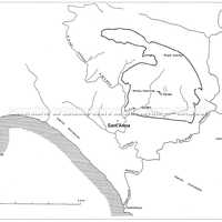
Plans of the ásty showing the distribution of the inhabited part of the city as well as its surroundings and the rivers that formed its boundaries: the Akragas (today's San Biagio) and the Hypsas (today's Sant'Anna). The ancient city of Akragas (roughly 450 hectares of territory) lies between three elongated hills: Monte Girgenti to the north-west, connected by a narrow isthmus to the hill called Rupe Atenea to the north-east, and the Hill of the Temples to the south. Monte Girgenti and the Rupe Atenea, which contain the highest points, are the candidates for the oldest acropolis of Akragas. Occupation extends from a Doric temple found beneath the church of Santa Maria dei Greci in the west to the small sanctuary of Demeter excavated beneath the medieval church of San Biagio in the east. Excavations here have made little progress, since this is where the medieval and modern city of Agrigento was built. Even so, excavations have identified there, on the slope of the Rupe Atenea, an olive-oil workshop from the first half of the 4th century BC, a 5th-century tower of unidentified function, and remains perhaps of houses from the beginning of the 3rd century BC.

Bibliography (9)
  • Mertens, D.; Città e monumenti dei Greci d’Occidente.
  • Frederiksen, R.; Greek City Walls of the Archaic Period, 900-480 BC (Oxford Monographs on Classical Archaeology)
  • Benevolo, L.; História da Cidade.
  • Hellmann, M.; L’ Architecture Grecque. 2. Architecture religieuse et funéraire.
  • Veronese, F.; Lo spazio e la dimensione del sacro: santuari greci e territorio nella Sicilia arcaica
  • Coarelli, F.; Torelli, M.; Sicilia - Guide Archeologiche Laterza.
  • Bollati, R.; Bollati, S.; Siracusa: genesi di una città. Tessuto urbano di Ortigia.
  • Carratelli, G. P. (ed.); The Greek world: art and civilization in Magna Graecia and Sicily.
  • Minà, P.; Urbanistica e architettura nella Sicília greca.

Forms of occupation of the khóra

Funerary spaces: necropoleis, scattered burials

Necropoleis, tholos and the monumental tomb of Theron. Tombs have been excavated both inside and outside the walls. The oldest Greek necropolis, of the Archaic period, was found in the area near the harbour. It was quite extensive, covering roughly 3 km. Tombs have also been found on the Rupe Atenea, beside the river Akragas and on the plain south of the sanctuary of Asclepius. Tombs dating between the 6th and 4th centuries BC have also been found in the area south and south-west of Monte Girgenti, especially during excavations for the construction of a railway there. It seems possible to see that most of the tombs lay outside the urban area proper, outside the walls; but since the chronology of both walls and cemeteries is imprecise and there is as yet no systematic study of the funerary landscape of the region, this cannot be stated categorically.

Bibliography (4)
  • Labeca,; Foto Acervo Labeca
  • Hellmann, M.; L’ Architecture Grecque. 2. Architecture religieuse et funéraire.
  • Veronese, F.; Lo spazio e la dimensione del sacro: santuari greci e territorio nella Sicilia arcaica
  • Florenzano, M. B. B.; Relatório científico de viagem ao exterior

Forms of occupation of the ásty

Residential areas

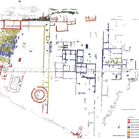
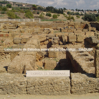
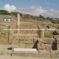
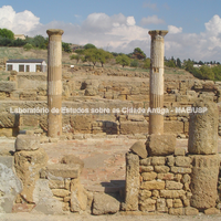
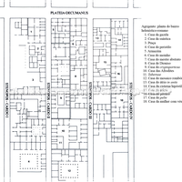
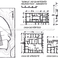
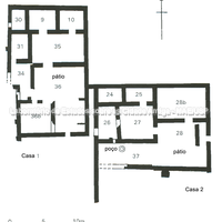
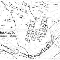
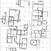
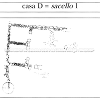
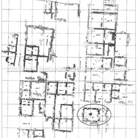
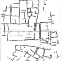
Housing. The most excavated and best-known part of the residential zone is the Hellenistic-Roman quarter right in the centre of the valley, east of the church of San Nicola. It followed the orthogonal grid street plan dating from the second half of the 6th century BC, and also the design of the quite sophisticated Hellenistic houses, in which the rooms were arranged around a central peristyle and probably had an upper floor where the gynaeceum was located. Shops (tabernae) have been identified among the houses.

Bibliography (7)
  • Labeca,; Foto Acervo Labeca
  • Nevett, L. C.; House and society in the ancient Greek world.
  • Veronese, F.; Lo spazio e la dimensione del sacro: santuari greci e territorio nella Sicilia arcaica
  • Florenzano, M. B. B.; Relatório científico de viagem ao exterior
  • Bollati, R.; Bollati, S.; Siracusa: genesi di una città. Tessuto urbano di Ortigia.
  • Carratelli, G. P. (ed.); The Greek world: art and civilization in Magna Graecia and Sicily.
  • Minà, P.; Urbanistica e architettura nella Sicília greca.

Borders

Natural features: rivers, topography, sea

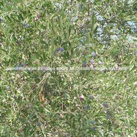
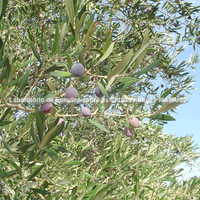
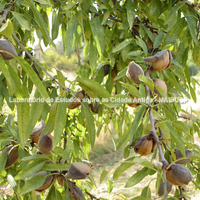
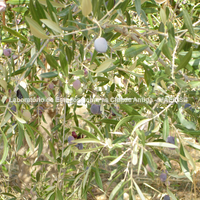
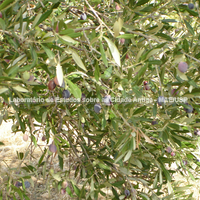
Olive trees. Olive growing was the basis of the economy throughout the ancient Mediterranean. Olive oil met energy needs in the diet, but was also used for lighting and perfumery. Many religious rituals in ancient Greece also incorporated olive oil: the dead were anointed, brides perfumed themselves, funerary stelae were anointed with perfumed oils, and so on. The olive tree is a plant that to this day is an integral and indispensable part of the landscape of the cities

Bibliography (1)
  • Labeca,; Foto Acervo Labeca

Forms of occupation of the ásty

Water management: channels, cisterns, wells

Water management. There was a system of underground aqueducts ending in a huge reservoir where, in the 5th century BC, there were fish, swans and a plant nursery, called the kolymbethra. It had a perimeter of 7 stadia and a depth of 20 cubits. Some scholars believe it lay outside the wall between gates V and VI on the northern slope of the Hill of the Temples, near the chthonic sanctuary. This is disputed, and so far no archaeological evidence of its position has been found. Between the sanctuary of Zeus and that of the chthonic deities, in the western part of the Hill of the Temples, in a residential area, a long portico housing several fountains was found. This complex dates from the Hellenistic period but overlies a system of cisterns and rainwater channels of the Archaic period. In addition, numerous elements of a 5th-century BC aqueduct network with an on-site water-collection system have been found scattered across the territory around the walls. In this connection it is worth recalling that the so-called Hypogeum of Purgatory, an important water-filtration complex, was excavated on Monte Girgenti.

Bibliography (2)
  • Labeca,; Foto Acervo Labeca
  • Florenzano, M. B. B.; Relatório científico de viagem ao exterior

Forms of occupation of the ásty

Walls and position of the gates

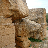
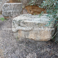
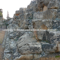
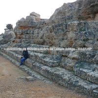
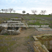
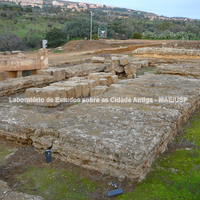
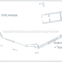
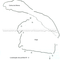
The whole of the most densely inhabited part of the settlement, corresponding to 450 ha, was enclosed by walls, although it was already naturally protected by the topography of the site. This wall dates from the mid-6th century BC and had 9 gates coinciding with the roads leading to the khóra and to the city's harbour. Gates I and II lay on the east side and III, IV and V on the south side, at the foot of the Hill of the Temples, opening the city towards the sea, the harbour and the mouth of the river Akragas. Of these 3 gates, gate V is the best-preserved monumental route in the western sector of the Hill of the Temples. This gate is arranged so that there is an oblique recess for 25 metres alongside the road entering the sanctuary of the chthonic deities, connecting to a large east–west plateia that runs through this sanctuary and also through the sanctuary of Zeus, then leads to the agora and on to gate II on the east side of the city. These three gates open onto an immense flat territory (Piano di San Gregorio) extending from the Hill of the Temples to the sea. They connect the urban area of the city with the outside world and probably with the agricultural areas to the south. Gates VI to IX are located on the west side of the urban centre.

Bibliography (9)
  • Miro, E. D.; Agrigento. I. I santuari urbani. L’area sacra tra il tempio di Zeus e Porta V. 2. Figure e Tavole.
  • Giovanni, G. d.; Agrigento - La Valle dei Templi, il Museo Regionale
  • Mertens, D.; Città e monumenti dei Greci d’Occidente.
  • Labeca,; Foto Acervo Labeca
  • Frederiksen, R.; Greek City Walls of the Archaic Period, 900-480 BC (Oxford Monographs on Classical Archaeology)
  • Hellmann, M.; L’ Architecture Grecque. 2. Architecture religieuse et funéraire.
  • Veronese, F.; Lo spazio e la dimensione del sacro: santuari greci e territorio nella Sicilia arcaica
  • Florenzano, M. B. B.; Relatório científico de viagem ao exterior
  • Coarelli, F.; Torelli, M.; Sicilia - Guide Archeologiche Laterza.

Relationship between ásty and khóra

Roads, streets, gates in the walls

The site chosen for the foundation of the city was near the coast, at an altitude varying between 300 and 350 metres above sea level. Its boundaries were marked by Monte Girgenti to the north, the Rupe Atenea to the east and the Hill of the Temples to the south, enclosing a territory of 450 hectares. The layout of the urban settlement in the first half of the 6th century BC is attested archaeologically only in small part, but this is enough to understand that the elements characterising the city in later centuries were already present from the foundation.

Bibliography (2)
  • Veronese, F.; Lo spazio e la dimensione del sacro: santuari greci e territorio nella Sicilia arcaica
  • Florenzano, M. B. B.; Relatório científico de viagem ao exterior