Leontinoi

Sicily (East)

According to Thucydides, Leontinoi was founded by the inhabitants of Naxos in 729 BC. It lies on the east coast of Sicily. In the 5th century BC it came within the expansionist sphere of Syracuse. In 413 BC it allied itself with the Athenians against Syracuse and, after the defeat of Athens, the city was practically abandoned by its inhabitants. After the destruction of Akragas by the Carthaginians in 406 BC, Leontinoi became an outpost of Syracuse, a base for mercenaries, exiles, etc. Nor could the city come to terms with Syracuse in Timoleon's time, when it allied itself with the Carthaginians, bringing about its final ruin. It was still occupied during the 3rd century BC, since both Plutarch (Marcellus, 14, 1-4) and Livy (XXIV, 30) relate how the consul Marcellus had the opportunity to raze the city in 214 BC.
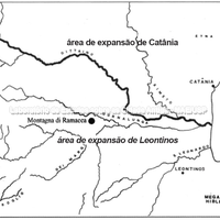
Leontinoi is set in the mountains, with access to a very fertile inland plain reaching almost to Morgantina in the heart of Sicily.

Forms of occupation of the khóra

Sacred areas: deposits, temples, shrines, sanctuaries, altars

Archaic sanctuaries related to Leontinoi, although located in indigenous territory. They reflect a sharing of cult with the inhabitants who were in Sicily before the arrival of the Greeks, with whom the latter maintained relations.
Bibliography (1)
  • Veronese, F.; Lo spazio e la dimensione del sacro: santuari greci e territorio nella Sicilia arcaica
Borders

Markers: horoi, phrouria, sanctuaries, harbours.

PHROURION

Bibliography (1)
  • Veronese, F.; Lo spazio e la dimensione del sacro: santuari greci e territorio nella Sicilia arcaica

Forms of occupation of the ásty

Urban grid: acropolis, block, agora, plateiai, stenopoi, orientation

Few structures have been discerned at Leontinoi by archaeologists.
Of the agora, whose remains have not been found, we can only presume, on the basis of Polybius, that it lay to the north of the S. Mauro valley and was more of an administrative centre than anything else. Its position, however, was an 'articulating' one, between the two hills, as we can also presume regarding the position of the agora at Herakleia.

Bibliography (2)
  • Mertens, D.; Città e monumenti dei Greci d’Occidente.
  • Labeca,; Foto Acervo Labeca

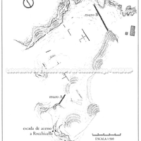
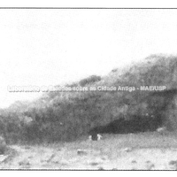
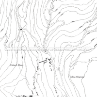
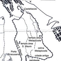
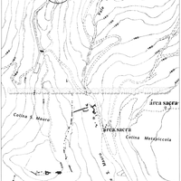
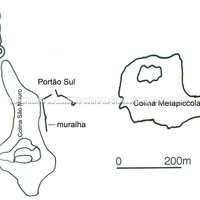
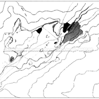
The city of Leontinoi lies on two hills roughly 200 m above sea level, the San Mauro hill and the Metapiccola hill, and also occupies the valley between them, called Valle S. Mauro. The oldest settlement occupied only the first of these hills and was surrounded by a wall. This wall was later extended to include the whole area occupied in the Classical period, the Metapiccola hill and the San Mauro valley.
Unfortunately, what can be seen of the city today is not very systematic: undoubtedly because of the troubled life of this colony and the many destructions it suffered, but also because the excavations have been irregular and scattered. There is a text by Polybius that has been widely used to describe the city. This 2nd-century author tells us: "The city of Leontinoi faces generally north. In the centre there is a flat valley where the seats of the magistrates and the law courts are, in a word, the agora. Each side of the valley is closed by a hill with continuous slopes: their terraces, beyond the edges, are covered with houses and temples. The city has two gates, one of which is at the southern end of the valley and leads to Syracuse; the other leads to the so-called 'fields of Leontinoi', that is, to the cultivated zone. At the foot of one of the cliffs, the western one, flows a river called the Lissos. Parallel to it, at the foot of the slope, there is a continuous line of quite numerous houses, separated from the river by the street I mentioned earlier" (VII, 6, 1-6).
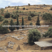
Of Polybius' description, the two hills can be seen perfectly today, San Mauro to the west and Metapiccola to the east, as well as the S. Mauro valley and one or two excavated sectors of the site in this area. On the north side of the valley, the river S. Eligio, which joins the S. Mauro, can be identified with the river Lissos mentioned by Polybius.
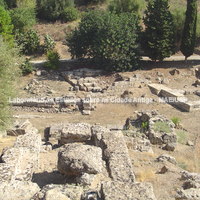
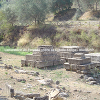
According to Diodorus, there were two acropoleis at Leontinoi in the time of Dionysius I, that is, the end of the 5th and the first half of the 4th century. However, little has been found: on the Metapiccola hill the foundations of a 6th-century temple without peristasis were excavated. A short distance from it, but still inside the walls, a votive deposit dated to the second half of the 6th century was found, with offering material and traces of the construction of a small shrine.
Two extra-urban sanctuaries (end of the 7th to the 5th century) have also been excavated: one on the Alaimo hill and another on the Scala Portazza hill, the latter probably dedicated to Hera. The material from these two sanctuaries is on display in the Regional Museum of Lentini.
Also at Metapiccola, some houses dated to the 6th century have been excavated.

From the existing evidence, and even with Polybius' detailed description, it can be concluded that Leontinoi did not have an orthogonal urban layout.

Bibliography (5)
  • Mertens, D.; Città e monumenti dei Greci d’Occidente.
  • Frederiksen, R.; Greek City Walls of the Archaic Period, 900-480 BC (Oxford Monographs on Classical Archaeology)
  • Veronese, F.; Lo spazio e la dimensione del sacro: santuari greci e territorio nella Sicilia arcaica
  • Coarelli, F.; Torelli, M.; Sicilia - Guide Archeologiche Laterza.
  • Longo, F.; Jannelli, L.; Cerchiai, L.; The Greek Cities of Magna Graecia and Sicily.

Borders

Natural features: rivers, topography, sea

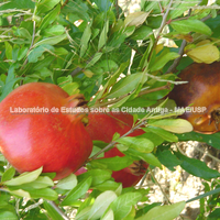
The pomegranate is a common fruit throughout Mediterranean Europe. In ancient Greece the pomegranate played an important role in myths and rituals related to the underworld and to the fertility of the earth and of women.

Bibliography (2)
  • Labeca,; Foto Acervo Labeca
  • Florenzano, M. B. B.; Relatório científico de viagem ao exterior

Museum

Archaeological object

x

Forms of occupation of the khóra

Funerary spaces: necropoleis, scattered burials

Outside the walls, near the Syracuse gate, an important necropolis was excavated, used from the beginning of the 4th century BC to the last years of the 3rd century BC, a period roughly coinciding with the Roman conquest of Sicily.
Two burial areas have been found at Leontinoi. Outside the walls on the south side, along the road leading to Syracuse, there is a necropolis with burials dating from the 6th to the 3rd century BC. Naturally, what is visible today are the tombs of the most recent period, but the material from the other, older graves is preserved and displayed in the Regional Museum of Lentini, which was visited. On the north side, also outside the walls, are most of the graves of this Greek apoikia. The oldest graves (7th century) were excavated beneath today's Via Garibaldi in the modern town of Lentini (information from the Museum).

Bibliography (2)
  • Labeca,; Foto Acervo Labeca
  • Florenzano, M. B. B.; Relatório científico de viagem ao exterior

Forms of occupation of the ásty

Walls and position of the gates

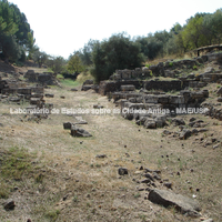
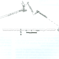
The oldest settlement occupied only the San Mauro hill, to the west, and was surrounded by a wall whose remains have been dated to the 6th century BC. This wall was later extended to include the whole area occupied in the Classical period.
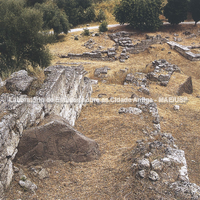
According to a passage of Polybius, the city had two gates, one of which was at the southern end of the valley and led to Syracuse; the other led to the so-called 'fields of Leontinoi', that is, to the cultivated zone.
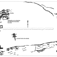
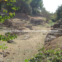
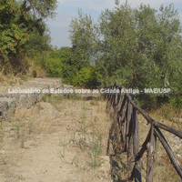
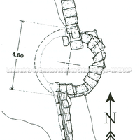
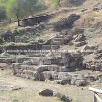
On the south side of the S. Mauro valley we visited several preserved stretches of the walls. These stretches can be dated to the 6th century, with phases of abandonment and destruction and phases of additions and rebuilding between the 5th and 3rd centuries. The 4th-century remains of the south gate which – as Polybius tells us – led to Syracuse are quite visible. This is a pincer-type gate. Accepting Polybius' testimony, we can understand that the connection with the cultivated areas, with the khóra, was made through the north gate, which leads precisely to the very fertile plain of Catania, where we presume the most cultivated areas connected with Leontinoi lay.

Bibliography (4)
  • Mertens, D.; Città e monumenti dei Greci d’Occidente.
  • Labeca,; Foto Acervo Labeca
  • Frederiksen, R.; Greek City Walls of the Archaic Period, 900-480 BC (Oxford Monographs on Classical Archaeology)
  • Florenzano, M. B. B.; Relatório científico de viagem ao exterior