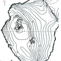
Zagora. General map of the settlement, dated to the 10th–8th centuries BC, on the island of Andros in the Aegean. Representation of elements of the urban fabric concentrated on the plateau. (Drawn by the author – Andersen)
Full-size image restricted
Nausitoo images are intended exclusively for academic research and teaching. To view them at full size, register and accept the Terms of Use, or sign in.