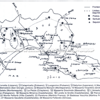
Map of the territory of Taranto (Lo Porto 1990). The numbers in circles indicate the sites that certainly belonged to the Tarentine khóra.
Full-size image restricted
Nausitoo images are intended exclusively for academic research and teaching. To view them at full size, register and accept the Terms of Use, or sign in.