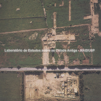
Aerial view of the excavation area south of the road. The municipal road runs parallel to the ancient streets, the most important of which is B, visible in the wide excavation trench south of the road. To the north (below), three blocks, C7, C8, C9, separated by stenopoi C7 and C8, with dwellings ranging in this area from the 6th century to the 2nd–1st centuries BC (the western blocks were in fact partly rebuilt after the destruction of 258 BC). Pubbli Aer Foto.
Full-size image restricted
Nausitoo images are intended exclusively for academic research and teaching. To view them at full size, register and accept the Terms of Use, or sign in.