Thurii

Italy (South) (Lucania)

After the defeat suffered by Sybaris in 510 BC, the Sybarites tried repeatedly, but without success, to refound their city. Finally, in 446 BC, with the help of a contingent of Athenians and other Greeks from the Peloponnese, they founded a new Sybaris. The life of this new city was short, since the old Sybarites could not reach agreement with the new colonists. The Athenians, who led this group, together with other Greeks who came from the mother country, finally brought about the foundation of Thurii in 444 BC. This was a Panhellenic foundation, proposed by Pericles and made in the territory of ancient Sybaris. Thurii became famous in the written tradition for welcoming Hippodamus of Miletus, who is said to have designed the city's urban grid; Herodotus, who probably spent the end of his life there and was buried in the agora of Thurii; and Protagoras, who is said to have written its constitution. In 194 BC the city was taken over by the Romans and renamed Copiae.

Forms of occupation of the ásty

Water management: channels, cisterns, wells

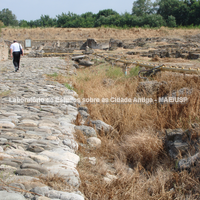
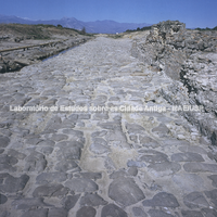
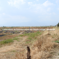
The city of Sybaris, and later that of Thurii, were established in a marshy area and went through several phases of drainage from antiquity onwards. Providing channels to carry away rainwater or wastewater and supplying clean water for use was a fundamental factor in any Greek city, especially in those in marshy areas such as this. All the streets were therefore provided with channels. Note that these cities, precisely because they lie in a marshy area, were discovered only in the first half of the 20th century, and that even today the archaeological site has to be permanently drained so that visitors can see it and archaeologists can work!
Bibliography (2)
  • Florenzano, M. B. B.; A contribuição das colônias ocidentais na construção da identidade poliade: subsídios do uso e da organização do espaço.
  • Florenzano, M. B. B.; Relatório científico de viagem ao exterior
Forms of occupation of the ásty

Residential areas

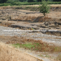
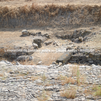
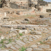
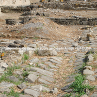
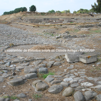
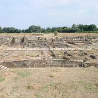
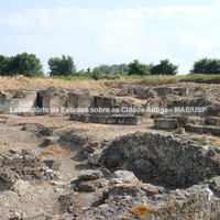
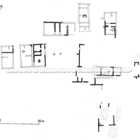
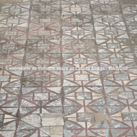
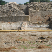
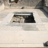
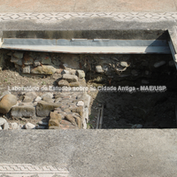
Most of the houses found at Thurii and visible today at the archaeological site date from the Roman period. Even so, many of them reused what remained of the Greek houses or were built over them. In some of our images this is clearly visible: the city's three levels of occupation are materially revealed by the archaeological excavations: the great and powerful city of Sybaris, destroyed by the Crotoniates in 510 BC; the period of abandonment of the city; the establishment of Thurii in the mid-5th century BC; and finally the Roman city, much smaller and less influential, in the 2nd century BC.

Bibliography (3)
  • Florenzano, M. B. B.; A contribuição das colônias ocidentais na construção da identidade poliade: subsídios do uso e da organização do espaço.
  • Florenzano, M. B. B.; Relatório científico de viagem ao exterior
  • Longo, F.; Jannelli, L.; Cerchiai, L.; The Greek Cities of Magna Graecia and Sicily.

Forms of occupation of the ásty

Urban grid: acropolis, block, agora, plateiai, stenopoi, orientation

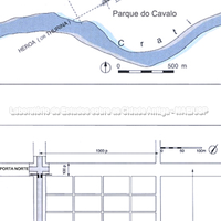
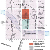
This reconstruction shows the territorial relationship between Archaic Sybaris and its successor, the Panhellenic foundation of Thurii. Because of internal conflicts, Thurii would not prosper and would later be taken over by the Romans, giving way to Copiae. As can be seen, excavations have shown that the areas inhabited by each did not coincide exactly, but there is nonetheless an overlap. Sybaris extended north towards the ancient river Coscile, while the others occupied the eastern part of the territory (in the Archaic period this area was covered by the sea). Later, Copiae occupied only the southern part of Thurii. In the excavations carried out, traces of all three superimposed occupations have been detected in some areas, as can be seen in the images.

Bibliography (4)
  • Hansen, M. H. (ed.); Nielsen, T. H. (ed.); An Inventory of Archaic and Classical Poleis.
  • Labeca,; Foto Acervo Labeca
  • Florenzano, M. B. B.; Relatório científico de viagem ao exterior
  • Longo, F.; Jannelli, L.; Cerchiai, L.; The Greek Cities of Magna Graecia and Sicily.

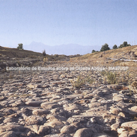
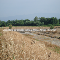
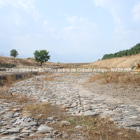
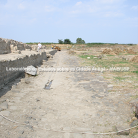
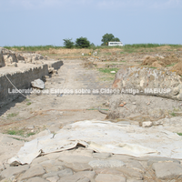
Even with the later occupation of the territory by the city of Copiae, the planned urban grid can still be seen today; as the images show, the ancient streets (plateiai and stenopoi) remained after the end of Thurii. Despite the construction of Roman buildings, the earlier occupations can be perceived through the structures found at the site.
Along plateia B, south of the urban grid, a public area identified as the forum of Copiae was located. Hypothetically we can also place here the Greek agora (or one of the agorai) of Thurii. It is mentioned in the written sources; Herodotus himself is said to have been buried in the agora. Strictly speaking, however, neither it nor its buildings have been identified (see Inventory, 2004: 304-307 for the texts). According to Diodorus (XII, 10,6), the urban core was surrounded by a wall, but archaeologically nothing has been found of it. At a place called Casa Bianca, in the south-east of the plan, along plateia B, a monumental gate with towers in the walls was located, opening onto what appear to be harbour installations on the river Crathis. Plateia B linked precisely this gate with the space of the Roman forum, where the Greek agora is thought to have been (Florenzano, 2006: 55).

Bibliography (5)
  • Florenzano, M. B. B.; A contribuição das colônias ocidentais na construção da identidade poliade: subsídios do uso e da organização do espaço.
  • Hansen, M. H. (ed.); Nielsen, T. H. (ed.); An Inventory of Archaic and Classical Poleis.
  • Labeca,; Foto Acervo Labeca
  • Florenzano, M. B. B.; Relatório científico de viagem ao exterior
  • Longo, F.; Jannelli, L.; Cerchiai, L.; The Greek Cities of Magna Graecia and Sicily.

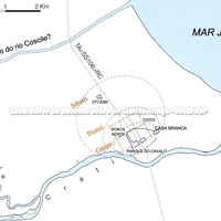
At Thurii the discussion of the urban grid is above all theoretical, since many texts about it have survived but very few material remains have been found so far. This discussion centres mainly on a very famous text by Diodorus Siculus (XII, 10,6-7) describing the layout of the city (Florenzano, 2006: 55). The grid of Thurii was designed by Hippodamus of Miletus, who besides urban planning was also involved in the political debate of the time; for this reason the way the city was built can be seen to be related to a model of ideal society. In representations of the city and in written documents we see how Thurii was planned: as mentioned above, the Greek historian Diodorus Siculus, who lived in the 1st century BC, described four plateiai crossing the city lengthwise and cut by another three plateiai across its width, resulting in large blocks which were divided by stenopoi. Again according to his account, these four main plateiai were called Herakleia, Aphrodisia, Olympias and Dionysias, while the three crossing them were called Heroa, Thuria and Thurina. Through in-depth study of the archaeological sites discovered – for example those identified on the plans referred to here as Parco del Cavallo, Prolungamento Strada and Casa Bianca – together with historical accounts, it has been possible to reconstruct the ancient urban area of Thurii and its street system; in addition, the remains of the ancient cities shown here in the images have been examined to understand how each of them functioned. Thurii, like Sybaris, was placed on the coast, between the rivers Crathis and Sybaris (today Coscile), which in antiquity were 3 km apart. The calculations made from the excavations, in the light of Diodorus' text, allow us to reconstruct a square city with two rows of blocks and an area of 70 hectares. According to the archaeological remains, the south side of the plan lay a short distance from the left bank of the river Crathis (Florenzano, 2006: 55).

Bibliography (6)
  • Florenzano, M. B. B.; A contribuição das colônias ocidentais na construção da identidade poliade: subsídios do uso e da organização do espaço.
  • Mertens, D.; Città e monumenti dei Greci d’Occidente.
  • Labeca,; Foto Acervo Labeca
  • Florenzano, M. B. B.; Relatório científico de viagem ao exterior
  • Longo, F.; Jannelli, L.; Cerchiai, L.; The Greek Cities of Magna Graecia and Sicily.
  • Carratelli, G. P. (ed.); The Greek world: art and civilization in Magna Graecia and Sicily.

The theatre of Thurii was found at Parco del Cavallo; in its present structure it is Roman.

Forms of occupation of the khóra

Residential areas: villages, farmsteads

The Stombi area is very interesting, because remains of houses dating from the 5th century BC – that is, after the destruction of Sybaris by Croton – were found here. However, these remains concern a single house and must therefore have been in the khóra of Thurii. On the other hand, many Archaic residential remains were also found, belonging to the period when this area was part of Sybaris. Part of the ásty of Sybaris, or already a peripheral residential quarter?

Bibliography (2)
  • Mertens, D.; Città e monumenti dei Greci d’Occidente.
  • Greco, E.; Magna Grecia: Guide Archeologiche Laterza.

Forms of occupation of the ásty

Work areas: workshops

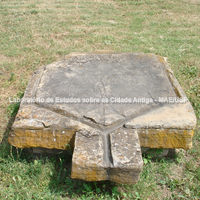
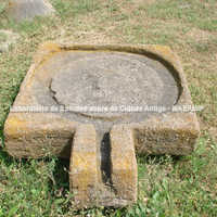
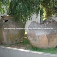
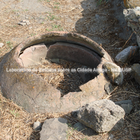
Some of the objects found at Thurii, now on display in the local Museum. Pithoi and implements for making oil and wine are important elements when found in excavations in a clear context. Their identification allows the archaeologist to understand the function of the structures being excavated. Pithoi are large containers used for storing both grain and oil.

Bibliography (3)
  • Labeca,; Foto Acervo Labeca
  • Florenzano, M. B. B.; Relatório científico de viagem ao exterior
  • Carratelli, G. P. (ed.); The Greek world: art and civilization in Magna Graecia and Sicily.