Olbia

Black Sea (Black Sea)

"Beyond the trading port of the Borysthenites, which lies midway along the coast of Scythia, the first inhabitants are the Callippidae, who are Greek Scythians; and beyond them is a tribe called the Alazones; these and the Callippidae live like the Scythians, sowing and eating grain, onions, garlic, lentils and millet. Above the Alazones live the farming Scythians, who sow grain not to eat but to sell; north of them the Neuri; north of the Neuri the land is uninhabited as far as we know." (Herodotus. IV. 17)
Olbia lies at modern Parutino, at the confluence of the river Bug (Hypanis) and the Dnieper (Borysthenes). 38 km south-west of Parutino and 2 km from the mainland lies the island of Berezan, formerly a peninsula to the south at Viktorovka (near Ochakiv); it is known that the peninsula became an island after the first Greek settlement.
"Olbia had ample potential for territorial and demographic growth (which distinguishes the city from the island of Berezan), and so became a political and economic centre of the lower Bug region in the 5th century BC. During the confused period of ethno-political instability in Scythia, Olbia evidently served as a refuge for various populations from outlying regions." (Solovyov, 1999: 111)

Forms of occupation of the ásty

Residential areas

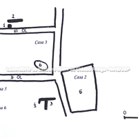
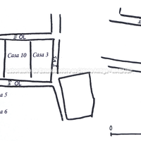
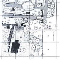
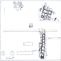
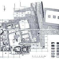
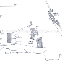
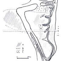
Plans of the residential areas.
North of the temenos there was a sacred grove, residential areas and metalworking workshops. South of the agora there were also residential areas with workshops, kilns and traces of metal slag.
Bibliography (1)
  • Wasowicz, A.; Olbia Pontique et son territoire: L’amenagement de l’espace.

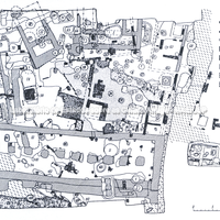
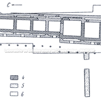
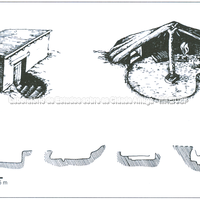
Reconstruction of the pit houses of Olbia.

Bibliography (3)
  • Solovyov, S. L.; Ancient Berezan: The Architecture, History and Culture of the First Greek Colony in the Northern Black Sea.
  • Carter, J. C.; Discovering the Greek Countryside at Metaponto.
  • Cicala, L.; L’edilizia domestica tardo arcaica di Elea.

Forms of occupation of the ásty

Water management: channels, cisterns, wells

In the agora there are important hydraulic installations: a reservoir, conduits in underground galleries (pipes joined with lead); there are wells 4 m deep.

Bibliography (1)
  • Wasowicz, A.; Olbia Pontique et son territoire: L’amenagement de l’espace.

Forms of occupation of the khóra

Structures marking the extent of the territory

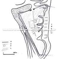
The territorial occupation of Olbia is circular in form; at its peak, in the Hellenistic period, it must have covered between 33 and 50 ha. Founded in the first half of the 6th century, it was already fully developed by the second half of the same century. In the khóra of Olbia 323 sites of various dates have been found.
In the Classical period there were about 107 rural settlements of various sizes: 0.2 ha (small); 2–3 and 5–8 ha (medium); and 50 to 80 ha (large). The population of the khóra included Greeks and non-Greeks; cereal farming (wheat, barley), horticulture and the raising of cattle, sheep, goats and pigs were practised.

Bibliography (1)
  • Wasowicz, A.; Olbia Pontique et son territoire: L’amenagement de l’espace.
Forms of occupation of the ásty

Urban grid: acropolis, block, agora, plateiai, stenopoi, orientation

The polis was divided into an upper part, 38 m above sea level, and a lower part at sea level.
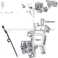
By the second half of the 6th century the occupation of Olbia was complete: residences, workshops, religious buildings; an agora was created with public buildings around it. The agora and the temenos took shape at this time and were connected by a paved road; a road crossed the city from north to south and ran along the western part of the agora (dating from the same period). This description corresponds to the layout of the "upper city". The organising role of the agora was consolidated over time.

Bibliography (1)
  • Wasowicz, A.; Olbia Pontique et son territoire: L’amenagement de l’espace.
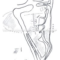
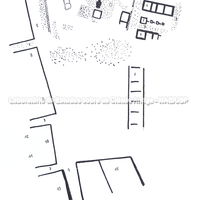
Maps of Olbia highlighting the agora.
"By the middle of the 5th century BC, the polis of Olbia had become the sole political, economic and above all religious centre in the Lower Bug region. By virtue of having taken in the former residents of Berezan, Olbia received the right to a second name: Borysthenis. This name apparently belonged to Olbia when the city was visited by Herodotus. His references (Hdt. 4.17-18, 24) to the demotikon 'Olbiopolites' and to the toponyms 'Borysthenes/Borystheneiteon emporion' suggest that Herodotus probably heard both names." (Solovyov, 1999: 113)

Bibliography (3)
  • Solovyov, S. L.; Ancient Berezan: The Architecture, History and Culture of the First Greek Colony in the Northern Black Sea.
  • Institut, D. A.; Archäologischer Anzeiger. (2005)
  • Wasowicz, A.; Olbia Pontique et son territoire: L’amenagement de l’espace.
Forms of occupation of the khóra

Funerary spaces: necropoleis, scattered burials

Olbia, like other apoikiai of the Black Sea, shows from the earliest times a clear structuring and differentiation of spaces, establishing public and political, economic and burial areas. "On the basis of the analysis of aerial photographs, P. Alexandrescu showed that from Istria numerous roads spread out, crossing the necropolis, leading to the villages of the khóra, exactly as at Olbia." (Wasowicz, 1983:919)

Bibliography (2)
  • Solovyov, S. L.; Ancient Berezan: The Architecture, History and Culture of the First Greek Colony in the Northern Black Sea.
  • Wasowicz, A.; Olbia Pontique et son territoire: L’amenagement de l’espace.

Museum

Archaeological object

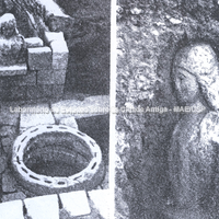
Kouros found in the gymnasium of the site.

Bibliography (1)
  • Wasowicz, A.; Olbia Pontique et son territoire: L’amenagement de l’espace.

Borders

Natural features: rivers, topography, sea

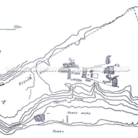
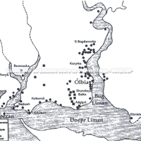
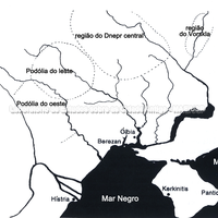
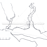
Maps of the coast of Scythia with the island of Berezan near Olbia.
The Dnieper-Bug estuary region on the north-western coast of the Black Sea.
The estuaries of the rivers (Bug, Dnieper, Istros) were favoured by the newcomers (mainly Milesians). The islet of Berezan and the city of Olbia, opposite, are close to the mouths of the Bug (Hypanis) and the Dnieper (Borysthenes), and Berezan should be identified with the Milesian emporion of the Borysthenites mentioned by Herodotus (IV,17,24 and 78) (Gras, 1998)
Greek occupation on the Black Sea was very dense: around Olbia, for example, 107 Archaic sites have been found, including settlements, necropoleis and farmsteads (Gras, 1998), and 323 of various dates.

Bibliography (2)
  • Solovyov, S. L.; Ancient Berezan: The Architecture, History and Culture of the First Greek Colony in the Northern Black Sea.
  • Gras, M.; O Mediterrâneo arcaico.

migration

images from the old database

.