Locri

Italy (South) (Bruttium)

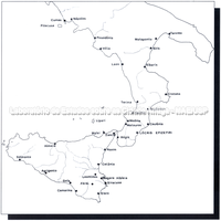
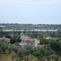
Locri Epizephyrii lies in the districts of Locri and Portigliola in the region of Calabria, on the Ionian Sea. The full form of the name of the polis is oi Lokroi oi epizephyrioi, a plural form corresponding to the name of the inhabitants: the Locrians who live at Zephyrion. Indeed, the polis was established in the area of Cape Zephyrion (today's Capo Bruzzano), so called because the high cliff there gave protection from Zephyrus, the west wind (Costamagna; Sabbione, 1990: 32-33).
The polis was founded by Greeks from Locris, a region of present-day Central Greece. The chronology of the foundation of Locri is controversial, since the literary sources preserve two different traditions: one goes back to Eusebius, who gives the year 673 BC, and the other to Strabo, who says that Locri was founded shortly after Syracuse (c. 733 BC) and Croton (710 BC), therefore at the end of the 8th century BC. The discovery of some aryballoi in the necropoleis of Lucifero and Parapezza – from Corinth and dated to 700 BC – has placed the foundation of Locri at the end of the 8th century BC (Costamagna; Sabbione, 1990: 32).
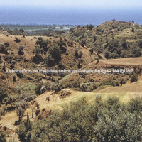
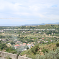
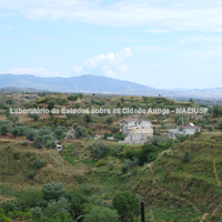
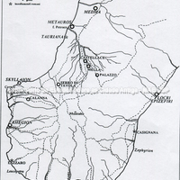
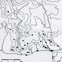
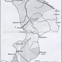
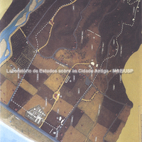
The territory of Locri consisted of the area between the rivers Sagra and Halex, which marked the northern border with Kaulonia and the southern border with Rhegion respectively. The inhabited area occupied a strip of coastal plain and a hilly zone characterised by the hills of Castellace, Abbadessa and Mannella, separated by valleys running lengthwise between them (Cerchiai, 2004: 95). These hills behind the coastal plain ensured good defensive conditions for the whole urban area, and their slopes, rich in springs, made Locri one of the cities best supplied with water on the Ionian coast (Costamagna; Sabbione, 1990: 43).
The area was previously occupied by a native population, the Sikels, as shown by the Iron Age settlement (9th–8th centuries BC) in the area of Contrada Janchina. At the time of the Greek foundation, the native population is said to have abandoned this settlement and moved inland.

Building techniques

Architectural details

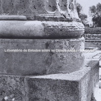
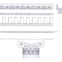
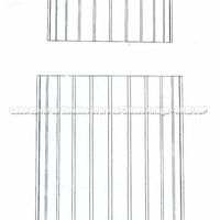
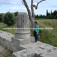
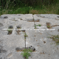
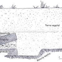
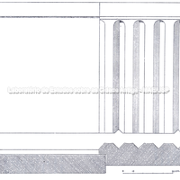
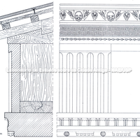
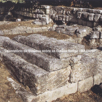
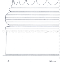
Every architectural detail in the buildings of the Greek cities (temples, houses, stoai, etc.) tells us about building techniques and provides elements for dating, often precisely, the period to which they belong. The way iron or bronze clamps were used to join the blocks of a temple's stylobate can help to date a building of which we have no other element than its foundations and stylobate. The base and number of flutes of a given column, whose upper drums and capitals have not survived, also tell us about the order of the temple.
Bibliography (3)
  • Mertens, D.; Città e monumenti dei Greci d’Occidente.
  • Labeca,; Foto Acervo Labeca
  • Florenzano, M. B. B.; Relatório científico de viagem ao exterior
Forms of occupation of the ásty

Urban grid: acropolis, block, agora, plateiai, stenopoi, orientation

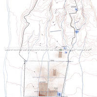
Plan of the polis and its territory
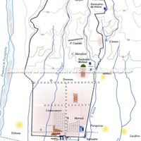
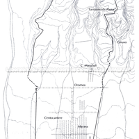
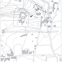
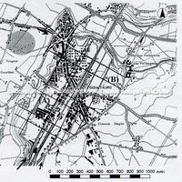
From the hills to the coast, the polis occupied an area of about 230 hectares.
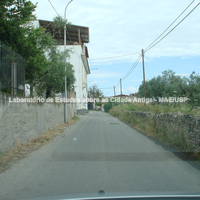
The lower part of the settlement of Locri, where the urban settlement was structured, dates from the mid-6th century BC, while the hilly sector was occupied sporadically, with large wild areas remaining. The urban layout was organised on three main axes, with two plateiai parallel to the coast oriented north/south and one orthogonal east/west plateia linking the coast to the hilly zone. The two parallel plateiai have been recognised on the ground in the Centocamere district and in the road called Dromos (Greco, 2008: 141). The Dromos divided the lower city from the hilly zone and ended on the west side at one of the gates of the polis. The road, now asphalted, crossed the whole width of the city and must have been built along the route of an ancient artery (Cerchiai, 2004: 96; Greco, 2008: 150).
At Locri Epizephyrii the public buildings connected with assembly and deliberation, such as the bouleuterion, the prytaneion and the ekklesiasterion, have not been found. Unfortunately the agora has not yet been located; it may have been in the area of the Dromos or at the foot of the neighbouring hills, but modern buildings and intensive cultivation in the area hinder the research needed to resolve what is the most obscure aspect of the city's layout (Costamagna; Sabbione, 1990: 62).
The earliest evidence of the use of space has been found in the necropoleis. Located outside the walls (the Greek burial pattern), research has located four necropoleis of the Greek period, the oldest material coming from the necropoleis of Lucifero, Parapezza and Monaci, all belonging to the north-eastern sector of the polis. At Lucifero and Parapezza the graves date from 700 BC and at Monaci from at least 680 BC. These necropoleis contain burials from the Archaic to the Hellenistic period. In the south-western sector of the city, near the Portigliola river, there is a single Greek necropolis, that of Tribona, where graves dating from the 5th century BC onwards have been found. The north-eastern necropoleis were separated from the urban area by a watercourse running straight along the walls, collecting the water of the Vallone Saitta. The necropoleis of Lucifero and Parapezza, closer to the coast, were probably related to a road leaving the city gate near the sanctuary of Marasà.
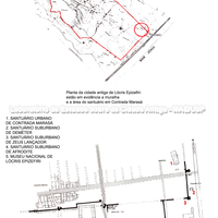
The sanctuaries of Locri are concentrated on the south-east, east and north-east sides; no sacred areas have been located in the western sector of the polis. There are seven main sanctuaries, located along the city walls, inside or outside, forming a sacred belt (Cerchiai, 2004: 100). The three best-known urban sanctuaries are those of Marasà (south-east), of Casa Marafioti and of Athena at Mannella; they are positioned on the north-eastern edge of the city, almost as if to signify a function of sacred control and protection of the limits of the urban area, as is thought in the case of Akragas. Other sanctuaries are suburban, outside the walls a short distance from them, such as the sanctuary of Persephone at Mannella and that of Grotta Caruso in the north-east sector, and those of Aphrodite, Demeter and Zeus Saettante in the south-east sector (Costamagna; Sabbione, 1990: 63).
The areas of the harbour, the theatre and the hills (Mannella) – always along the walls – were the places chosen for building the sanctuaries (Laky, 2013: 110).

Bibliography (12)
  • Mertens, D.; Città e monumenti dei Greci d’Occidente.
  • Labeca,; Foto Acervo Labeca
  • Frederiksen, R.; Greek City Walls of the Archaic Period, 900-480 BC (Oxford Monographs on Classical Archaeology)
  • Hellmann, M.; L’ Architecture Grecque. 2. Architecture religieuse et funéraire.
  • Serafino, C.; Locri Antica e il suo territorio.
  • Greco, E.; Magna Grecia: Guide archeologique Laterza
  • Laky, L. A.; Olímpia e os Olimpieia: a origem e difusão do culto de Zeus Olímpio na Grécia dos séculos VI e V a.C.
  • Costabile, F. (ed.); Polis ed Olympieion a Locri Epizefiri.
  • Florenzano, M. B. B.; Relatório científico de viagem ao exterior
  • Longo, F.; Jannelli, L.; Cerchiai, L.; The Greek Cities of Magna Graecia and Sicily.
  • Carratelli, G. P. (ed.); The Greek world: art and civilization in Magna Graecia and Sicily.
  • Sabbione, C.; Costamagna, L.; Una città in Magna Grecia. Locri Epizefiri: Guida Archeologica.

Theatre
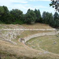
The largest surviving public building intended for non-religious activities is the theatre. Located at Contrada Pirettina, it was built into the natural hollow of the ground on the slopes of the Contrada Cusemi area, below the vicinity of the Casa Marafioti sanctuary. The theatre dates from the 4th century BC and underwent many alterations in the Roman period. It has a semicircular orchestra, and the complex consists of seven sectors divided by stairways and horizontally by a wide gangway (diazoma). Archaeologists do not rule out the use of the theatre for assemblies; we know, however, that the theatre was not connected with the agora, because immediately nearby are the remains of private buildings related to the stenopoi, an extension of those traced in the Centocamere district, so there was not enough physical space for the agora (Cerchiai, 2004: 102; Costamagna; Sabbione, 1990: 62; Greco, 2008: 150-151).

Bibliography (4)
  • Labeca,; Foto Acervo Labeca
  • Laky, L. A.; Olímpia e os Olimpieia: a origem e difusão do culto de Zeus Olímpio na Grécia dos séculos VI e V a.C.
  • Florenzano, M. B. B.; Relatório científico de viagem ao exterior
  • Sabbione, C.; Costamagna, L.; Una città in Magna Grecia. Locri Epizefiri: Guida Archeologica.

Forms of occupation of the ásty

Sacred areas: deposits, temples, shrines, sanctuaries, altars

Sanctuary of Aphrodite at Marasà
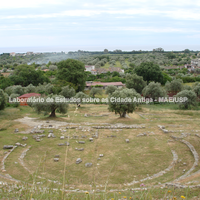
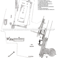
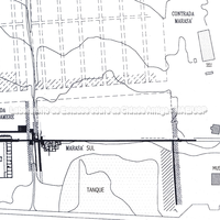
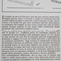
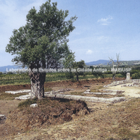
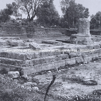
At Marasà there is an urban sanctuary with a temple of several building phases, probably dedicated to the goddess Aphrodite. The Ionic temple of Marasà, as it became known, suffered various depredations during the 19th century, until the first systematic excavations were carried out by Paolo Orsi and E. Petersen between 1889 and 1890 and by A. De Franciscis between 1955 and 1959. At the end of the 19th century P. Orsi and E. Petersen excavated the remains of the Archaic temple and of the subsequent Ionic temple, and in the 20th century De Franciscis extended the excavation, revealing the altars of the sanctuary and the neighbouring part of the walls with the gate and tower (Costamagna; Sabbione, 1990: 149).
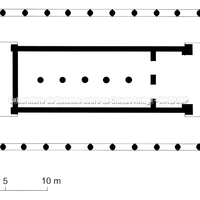
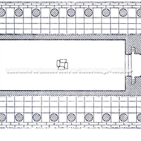
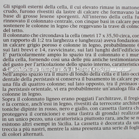
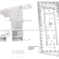
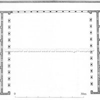
The first building phase of the temple goes back to the end of the 7th and beginning of the 6th century BC. The remains of this period revealed a building with a long, narrow cella measuring 22 x 8 metres, with an entrance porch to the pronaos, built of sandstone blocks. The inner walls were of mud brick and the entablature and columns of wood. The interior of the cella was lined with terracotta slabs painted with geometric motifs. Similar terracotta also protected the roof, which had eaves (simas) decorated with guilloche motifs. In the second phase (third quarter of the 6th century BC) the temple was rebuilt in wood and mud brick, and the foundations were made of limestone blocks. The interior of the cella, partly modified, had a row of square blocks serving as bases for the columns and for the opisthodomos with a four-column façade. In the opisthodomos there must also have been a similar façade on the opposite side, giving access to the pronaos. Around the cella there was a colonnade (peristasis) of about 17 x 35 metres, of which only part of the foundation remains. In this phase the temple had 6 x 14 columns, and the roof was covered with polychrome terracotta tiles similar to those used in Sicily at this time (Cerchiai, 2004: 100). The area around the temple was occupied at the southern corner by three bases for dedications and two foundations probably belonging to altars (Greco, 2008: 144).
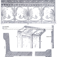
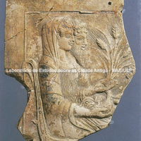
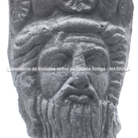
Around 480–470 BC this temple was demolished and rebuilt on a different orientation, very similar to the position of the temple in relation to the urban centre used at Metapontum and Poseidonia. The new building was built of a limestone possibly from Syracuse and was of the Ionic order; the foundations measured 19 x 45 metres and the stylobate 17.31 x 43.70 metres. The peristasis of 7 x 17 columns surrounded the cella, with a pronaos and opisthodomos each with two columns in antis. The discovery of smaller column drums has led to the suggestion that the pronaos may have had two rows of columns. Of the elevation of the temple there remain column fragments, with 24 flutes and a decoration of palmettes with lotus flowers, and fragments of capitals and cornices with simas with lion heads and floral motifs in stone, which were replaced during the 4th and 3rd centuries BC, some of them reused in the foundations of the House of the Lions. The traces of colour found on these fragments suggest that the architectural parts of the temple were painted red, blue and green (Cerchiai, 2004: 100; Greco, 2008: 145). As for the chronology of the temple, the date of 480 BC is based on the marble acroterion depicting the Dioscuri beside a Nereid (or Aphrodite) emerging from the sea. The dating of the acroterion was made possible by associating the decorative elements found at the rear of the temple, which belong to a period after its construction, therefore the end of the 5th century BC.
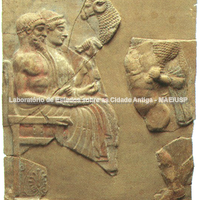
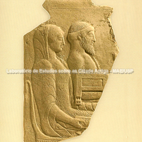
An important element of the cult – useful in identifying the deity worshipped in the temple – was the bothros, related to chthonic rituals, which after several phases of superimposed buildings was located in the area of the cella of the first Archaic building. One hypothesis holds that the temple was not built to house the cult statue, but to celebrate the ritual of the birth of Aphrodite around the bothros. According to the most recent hypothesis, the parapet of this bothros was the famous Ludovisi Throne. This consists of three marble panels, dated between 460 and 450 BC, the main one depicting the birth of Aphrodite rising from the sea between two nymphs who hold a veil over the lower part of the goddess's body. The panel to the left of the main one depicts a hetaira playing the flute, and the right one a veiled woman burning incense (Cerchiai, 2004: 101; Greco, 2008: 147-148).
The rectangular altar belonging to the Ionic temple is positioned to the east and dated to the 5th century BC. A stoa built near the wall to shelter the worshippers also belongs to this period. In the Marasà area, the votive deposit containing terracottas of female figures (6th and 5th centuries BC) and types of skyphoi (5th century BC) may have been created to clear the sanctuary of Marasà of excessive offerings, but this deposit may also have belonged to a place of worship not yet located on the outer edge of the city (Costamagna; Sabbione, 1990: 150).

Bibliography (8)
  • Labeca,; Foto Acervo Labeca
  • Borriello, M. R.; Rubino, P.; La Magna Grecia.
  • Greco, E.; Magna Grecia: Guide archeologique Laterza
  • Juliis, E. M. D.; Magna Grecia: L’Italia meridionale dalle origini leggendarie alla conquista romana.
  • Costabile, F. (ed.); Polis ed Olympieion a Locri Epizefiri.
  • Florenzano, M. B. B.; Relatório científico de viagem ao exterior
  • Longo, F.; Jannelli, L.; Cerchiai, L.; The Greek Cities of Magna Graecia and Sicily.
  • Sabbione, C.; Costamagna, L.; Una città in Magna Grecia. Locri Epizefiri: Guida Archeologica.

Sanctuary of Olympian Zeus at Casa Marafioti
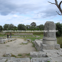
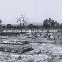
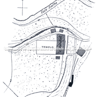
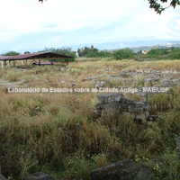
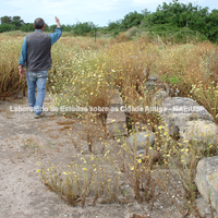
In the eastern sector, near the walls and in a high, commanding position, is the sanctuary of Casa Marafioti, on the upland of Contrada Cusemi, which extends down to the plain. The sacred area is urban, located 100 metres north-west of the theatre and about 90 metres north of the archive chest of Olympian Zeus, this whole complex of structures lying between the valleys of Milligri (to the west) and Saitta (to the east). In the 19th century the site of the sanctuary was called Casino Imperatore, later becoming known as the sanctuary of Casa Marafioti. At that time the Marafioti family built their house over the sacred area, mainly over part of the foundations of the temple, which is Doric and dated to the 6th century BC.
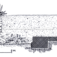
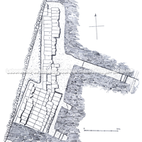
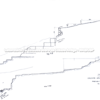
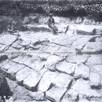
Excavated by P. Orsi in 1910 and 1911, the sanctuary was separated from the chest by a retaining wall built on the slope of the hill. The wall of Contrada Pirettina was made of isodomic sandstone blocks 2.5 metres wide, oriented east–west, and probably connected on the east to the Saitta valley. This wall structure may have been the peribolos (temenos wall) of the sanctuary of Casa Marafioti, or the analemma supporting the hill, or else, as P. Orsi thought, it may have had a military function besides a supporting one (Costamagna; Sabbione, 1990: 63-64; Costabile, 1992: 37 and 39).
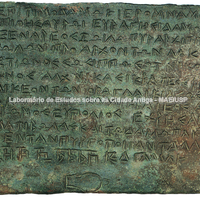
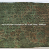
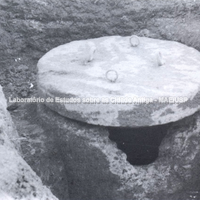
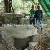
To this day the deity worshipped in the sanctuary remains uncertain. Scholars of Locri Epizephyrii associate this sanctuary with the archive chest of Olympian Zeus, discovered in 1959, almost 50 years after Orsi's excavations. The chest, located near the sanctuary (only 90 metres south of it), was a kind of stone pit in which 39 bronze tablets were found containing records of financial operations of the magistrates of Locri and loans made by the sanctuary of Olympian Zeus. It was discovered during farm work, and on that occasion the finders, unable to remove the heavy stone lid, damaged the side of the pit and took out some of the bronze tablets. Only after a few days did Ugo Serafino, a specialist from the Soprintendenza, manage to recover two tablets hidden in a stable. These were added to the thirty-seven found by the specialists inside the chest, but other material kept there may have been sold and dispersed (Costamagna; Sabbione, 1990: 261).
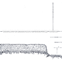
The chest was made from a single block of limestone, hollow and cylindrical inside, measuring 1.57 metres in diameter and 1.26 metres in height, with walls 31 cm thick. This pit was closed by a solid lid (38 cm thick), also of limestone, 1.48 metres in diameter, with a circular projection 90 cm in diameter on its underside that fits into the inner cavity of the chest, 95 cm in diameter. On the outside of the lid there are four pairs of thick rings of solid bronze, differing in size and fixing system. The two smaller rings (10 cm in diameter) are movable and set in small bronze sockets fixed deep in the lid; the other two, larger ones (13.8 cm in diameter) are set directly in the stone, in a fixed position, slightly inclined, one above the other. The most convincing explanation for this difference is that the larger fixed oblique rings were used to lift the lid by means of ropes attached to one or two pulleys suspended above the centre. The smaller movable rings could be used to shift the lid sideways once raised.
The 39 bronze tablets date from the democratic period of Locri, around the second half of the 4th century BC and the first half of the 3rd century BC. The texts, studied by the Italian archaeologist Alfonso De Franciscis, are written in the local Doric dialect with Athenian influence. The tablets are unique documentation in the whole Greek world and an exceptional source of information on the life and political organisation of the city in this period: the structure of public offices, the subdivision of the population, and the economic function of the sanctuary, which lent the polis sums of money, many of them intended for the restoration and strengthening of the wall circuit. One of the tablets mentions contributions to a basileus, who according to some scholars was a magistrate of the city and according to others Pyrrhus, king of Epirus (Costamagna; Sabbione, 1990: 164 and 261).
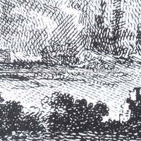
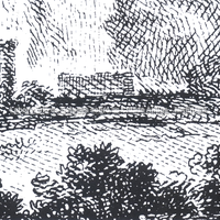
The sanctuary of Casa Marafioti housed a Doric temple that was already reported in modern times by some French and Italian travellers who passed through Calabria in the 18th and 19th centuries. Two of them, the Frenchmen Jean Claude Richard de Saint-Non and François Bielinski, in their works Voyage Pittoresque ou Description des Royaumes de Naples et de Sicile (1783) and Troisième Centaine que commence avec l'année 1791 (1791) respectively, described the area of the temple and, above all, recorded that even at that time (the last decades of the 18th century) two columns of the temple were still standing. A drawing of the view of the temple area made by Desprez for Saint-Non's work was enlarged by specialists and revealed the two columns of the Casa Marafioti temple (Costabile, 1992: 54).
The first to excavate the sanctuary and temple was the Duc de Luynes in 1830. In his report Ruines de Locres, published in the Annali dell'Istituto di Corrispondenza Archeologica, II (1830), he says that the last of the two remaining columns had been demolished two years earlier by a wine grower to serve as a fence for his garden (Costabile, 1992: 54-55).
The first systematic excavation of the Casa Marafioti temple was carried out by Paolo Orsi in 1910, who published the results in the article Il tempio dorico a Casa Marafioti, in Rapporto preliminare sulla quinta campagna di scavi nelle Calabrie durante l'anno 1910, Notizie degli Scavi (1911). In this report P. Orsi set down his impressions of the real state of the temple at the beginning of the 20th century, recording the condition of the building after the numerous depredations and the Duc de Luynes' intervention in the 19th century.
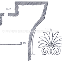
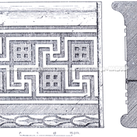
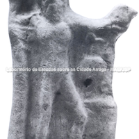
P. Orsi's excavations recovered a variety of architectural and sculptural elements of the temple, such as capitals and column fragments, parts of a pentaglyph from the entablature, almost complete parts of the temple's sima with lion heads, decoration with meanders and volutes from the cornice, and a sculpture of a horse and rider, the group of one of the building's acroteria.
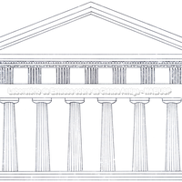
Even given the deplorable state of the temple ruins, specialists have established the date of the building (540/30 BC) and its architecture. It is a Doric peripteral temple of 20 x 36–40 m with 8 x 17 columns.

Bibliography (5)
  • Labeca,; Foto Acervo Labeca
  • Laky, L. A.; Olímpia e os Olimpieia: a origem e difusão do culto de Zeus Olímpio na Grécia dos séculos VI e V a.C.
  • Costabile, F. (ed.); Polis ed Olympieion a Locri Epizefiri.
  • Florenzano, M. B. B.; Relatório científico de viagem ao exterior
  • Sabbione, C.; Costamagna, L.; Una città in Magna Grecia. Locri Epizefiri: Guida Archeologica.

U-shaped Stoa
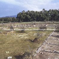
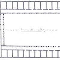
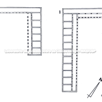
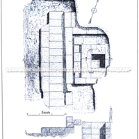
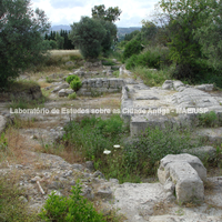
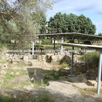
The U-shaped Stoa is usually associated with the cult of Aphrodite. The finds of skyphoi with dedicatory inscriptions to the goddess (dated to around the beginning of the 4th century BC) clearly show a connection between the pits (bothroi) and the cult. The presence of dog bones is also significant, since we know that dogs were sacrificed to Aphrodite in Thrace and Attica. Among the votive statuettes, the frequency of statuettes of symposiasts reclining on the kline is notable, indicating the connection of the cult with the world of the symposium (Costamagna; Sabbione, 1990: 213).
The confirmation of the connection with the cult of Aphrodite and the position of the building outside the wall circuit led Mario Torelli to propose that the cult of Aphrodite related to sacred prostitution was located there. The ritual – originating with the eastern goddess Ishtar – was introduced into some Greek cities such as Corinth, particularly connected with trade with the East and especially with the Phoenicians. It is plausible that a cult of foreign origin should have been located in a marginal position, outside the line of the walls, which separated it from the sanctuaries connected with the religious traditions of Locri (Costamagna; Sabbione, 1990: 213-214; Greco, 2008: 152-153; Torelli, 1976: 147-150).
In any case, stoai of this type were intended to offer shelter from the sun or bad weather in much-frequented public places. Among the most significant examples are the ancient stoa of the sanctuary of Hera on Samos (dated c. 600 BC) and the two stoai that bounded the agora of Megara Hyblaea in Sicily (dated to around the second half of the 7th century BC). These are therefore buildings for immediately practical use, which are considered secular even when located within a sacred area (Costamagna; Sabbione, 1990: 211).

Bibliography (6)
  • Mertens, D.; Città e monumenti dei Greci d’Occidente.
  • Labeca,; Foto Acervo Labeca
  • Torelli, M.; I culti di Locri
  • Hellmann, M.; L’ Architecture Grecque. 2. Architecture religieuse et funéraire.
  • Greco, E.; Magna Grecia: Guide archeologique Laterza
  • Sabbione, C.; Costamagna, L.; Una città in Magna Grecia. Locri Epizefiri: Guida Archeologica.

Forms of occupation of the khóra

Position in relation to the walled area

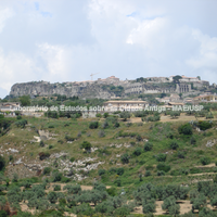
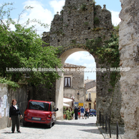
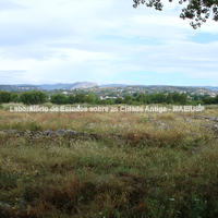
Today, much of the area of the ancient polis is sparsely inhabited by modern rural houses. To the north of its territory is the medieval town of Gerace Superiore, whose inhabitants reused stones from the buildings of the Greek city to build their homes.

Bibliography (3)
  • Mertens, D.; Città e monumenti dei Greci d’Occidente.
  • Labeca,; Foto Acervo Labeca
  • Florenzano, M. B. B.; Glossário Profa. Maria Beatriz Borba Florenzano

Reconstructions

Reconstructions

The drawings made by travellers and artists who visited the sites of the Greek cities in the 18th and 19th centuries recorded the state of the ruins at the time, providing us with information on structures that have in most cases reached us completely destroyed.

Bibliography (1)
  • Costabile, F. (ed.); Polis ed Olympieion a Locri Epizefiri.

Forms of occupation of the khóra

Structures marking the extent of the territory

Metauros lies at the source of the river Metauros/Petrace; it was a foundation of Rhegion intended to counter Locri, which had founded Medma and Hipponion. But Metauros passed into the orbit of Locri in the 6th century BC (Gioia Tauro). Medma and Hipponion had the structure of a polis, while Metauros was more indigenous and had the structure of a trading post (emporion). According to specialists, Metauros remained an area disputed between these two poleis in antiquity.

The whole hinterland of southern Calabria, with coastlines on the Tyrrhenian and Ionian Seas, was disputed between the two cities of Rhegion and Locri, which founded military outposts and other settlements such as Metauros, Hipponion and Medma. This whole region had indigenous populations which, influenced by the Greeks, joined or supported one polis or another.

Forms of occupation of the khóra

Sacred areas: deposits, temples, shrines, sanctuaries, altars

Sanctuary of Persephone at Mannella
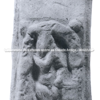
In the north-eastern sector – the highest area of the city – there are two sanctuaries: a suburban one dedicated to Persephone and an urban one dedicated to Athena, both built beside the walls. The sanctuary of Persephone was the oldest sacred area and the one active for the longest time. Small terracotta plaques bearing scenes from the myth of Persephone – the so-called pinakes of Locri – date from the mid-7th century BC to the 5th century BC and indicate the initial phase of activity of the sanctuary. Italiote red-figure pottery, Hellenistic statuettes and coins of Pyrrhus and of Alexander the Great show that the cult of the goddess was still active in the 4th and 3rd centuries BC; it was abandoned in the Roman Imperial period (Costamagna; Sabbione, 1990: 283). Numerous pinakes (terracotta plaques) with scenes of the cult of Persephone have been found/produced at Locri.
The identification of the celebrated Persephoneion – recalled by Diodorus (XXVII) as the most famous sanctuary in southern Italy – with the sanctuary on the Mannella hill is assured, as P. Orsi said, not only by the inscriptions of dedications to the goddess, but by the precise correspondence between the topographical account of the source and the particular conformation of the site: outside the wall and accessible through it. The narrow, enclosed valley at the level of Mannella and Abbadessa is particularly suggestive for a place of worship of an infernal and chthonic deity.
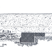
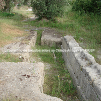
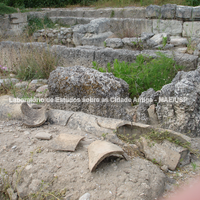
The sanctuary was built in the valley of the Abbadessa hill, on the south-western slope of the Mannella hill, near a gate and the walls. During excavations at the site between 1908 and 1911, P. Orsi found two large retaining walls on either side of the watercourse, creating a barrier against the passage of water. Orsi saw in this structure not only a military and hydraulic work, but the desire to monumentalise the access to the sanctuary, used by those coming from the city. Visitors thus recognised in the passage a real gateway used when the torrent was dry, and in the great retaining walls the support for a bridge in times of flood (Costamagna; Sabbione, 1990: 278). Another structure, a barrier wall 110 metres long and 2.5 metres wide, ran towards the hill almost at a right angle. This was the temenos of the sanctuary, characterised by the absence of a real temple, which is not rare in the case of chthonic deities (Costamagna; Sabbione, 1990: 278 and 283). In the space between the retaining walls and the barrier wall, thousands of votive objects (including the pinakes) dedicated to the goddess were discarded, probably on the occasion of the general restructuring of the sanctuary. It is interesting to recall that before being discarded, the votive objects were broken intentionally and ritually, because, once unusable, they would remain forever dedicated to the deity.
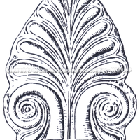
The only religious structure identified was the floor of a small building with a square pit, made like a strongbox for keeping the most valuable votive objects. The building itself was completely destroyed, and P. Orsi suggested an aedicula (a kind of small temple) decorated with an anthemion and antefixes with female heads, of which only fragments remain. The building has been dated to the 5th century BC, it being assumed that it was built at the time of the restructuring of the sanctuary, when the offerings were buried (Costamagna; Sabbione, 1990: 283; Cerchiai, 2004: 103; Greco, 2008: 150).

Bibliography (5)
  • Borriello, M. R.; Rubino, P.; La Magna Grecia.
  • Greco, E.; Magna Grecia: Guide archeologique Laterza
  • Costabile, F. (ed.); Polis ed Olympieion a Locri Epizefiri.
  • Longo, F.; Jannelli, L.; Cerchiai, L.; The Greek Cities of Magna Graecia and Sicily.
  • Sabbione, C.; Costamagna, L.; Una città in Magna Grecia. Locri Epizefiri: Guida Archeologica.

Sanctuary of Grotta Caruso
Between the north-eastern and eastern sectors of the polis, in a suburban position, lies the sanctuary of the Nymphs. Outside the wall circuit, at the foot of a steep slope at Contrada Caruso, there was a natural cave from which a spring gushed. Worship at the site developed from the 6th century BC to the 2nd century BC; it was the seat of the cult of the Nymphs, but also of Pan and Silenus. There, P.E. Arias' excavations in 1940 revealed a rich deposit of votive terracottas dated mainly from the 4th to the 2nd century BC. Some of these terracottas are busts and statuettes of seated female figures, caves and small plaques with scenes of Silenus, symbols of the cult of Dionysus and river deities half bull, half man. The only structure built in the area of the cave was a kind of reservoir, of the Hellenistic period, made for the spring. The cult of the Nymphs at Grotta Caruso is associated with Euthymos, a Locrian Olympic victor who was deified (in the form of a river god) during his lifetime for having defeated the demon that terrorised the city of Temesa (Cerchiai, 2004: 103; Costamagna; Sabbione, 1990: 154-156; Greco, 2008: 149).

Bibliography (3)
  • Greco, E.; Magna Grecia: Guide archeologique Laterza
  • Longo, F.; Jannelli, L.; Cerchiai, L.; The Greek Cities of Magna Graecia and Sicily.
  • Sabbione, C.; Costamagna, L.; Una città in Magna Grecia. Locri Epizefiri: Guida Archeologica.

Sanctuary of Demeter at Parapezza
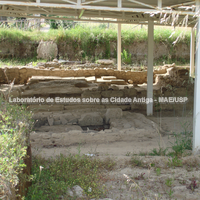
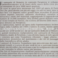
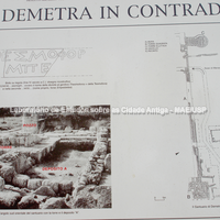
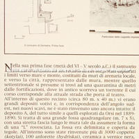
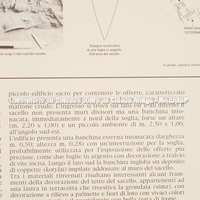
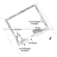
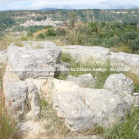
In the south-eastern sector are the sanctuaries of Demeter and of Zeus Saettante, at Parapezza, and of Aphrodite, at Centocamere and Marasà. The sanctuary of Demeter lies at the beginning of the eastern stretch of the walls and was active as a place of worship from the second half of the 6th century to the 3rd century BC (Cerchiai, 2004: 103). In the Archaic period the sanctuary covered an area of 40 x 80 metres and had a sacellum of 7.65 x 9.20 metres of simple architecture without columns, made of mud brick, with small benches along the walls for displaying the offerings. Inside the structure, opposite the entrance, stood the altar. This building dates from between the mid-6th and the 5th century BC and was demolished in the first half of the 4th century BC during the rebuilding of the walls. Further north of the excavated area there is another building, dated between the 6th and 5th centuries BC, identified as a banqueting hall. In the sanctuary area there are also the remains of an enclosure (7.5 x 15 metres) built in a mixed technique (with irregular stones and fragments of tiles and bricks). These are the remains of the 4th- and 3rd-century BC sanctuary of Demeter. Within the enclosure are also parts of a small altar built of tiles, with four terracotta pipes set vertically in the ground inside, typical of altars of chthonic deities, used for libations. In this period the sanctuary was reorganised after the construction of the square tower, which obliterated the oldest part of the sacred area (Cerchiai, 2004: 103; Greco, 2008: 143).
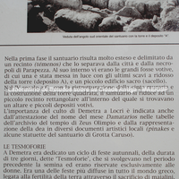
The attribution of the area to Demeter was made possible by the inscription Thesmophoros on a situla (bucket-shaped vessel). Thesmophoros was the epithet of Demeter as protector of marriage and of rites of passage. The cult was also confirmed by the large quantity of votive material (miniature pottery, cups and hydriai, female statuettes) and cult paraphernalia found in several pits excavated in the sacred area outside the walls (Greco, 2008: 143).

Bibliography (4)
  • Labeca,; Foto Acervo Labeca
  • Greco, E.; Magna Grecia: Guide archeologique Laterza
  • Florenzano, M. B. B.; Relatório científico de viagem ao exterior
  • Longo, F.; Jannelli, L.; Cerchiai, L.; The Greek Cities of Magna Graecia and Sicily.

Sanctuary of Zeus "Saettante" at Parapezza
At Parapezza there was also a sanctuary dedicated to Zeus, named Saettante ("Thunderbolt-hurler") by Italian archaeologists. The suburban sacred area was identified in 1961 from nine votive pits found at the eastern corner, outside the walls, beneath a Roman building connected with farming. The deposit included miniature votive hydriai and oinochoai and numerous terracottas of a naked Zeus, shown frontally, hurling a thunderbolt with his right arm, wearing a diadem on his head and a cloak over his back, holding an eagle on his left arm, with an oinochoe on an altar below (Costamagna; Sabbione, 1990: 150). The terracottas of Zeus date from the 4th and 3rd centuries BC. The type of Zeus hurling the thunderbolt with his right arm and holding an eagle with his left is common in the Greek world, but the other elements in the image (diadem, oinochoe and altar) are local additions to this standard image of the god. Italian archaeologists have characterised the area of the pits as a sanctuary dedicated to Zeus, although no cult building, temenos wall or altar has been found. It should be noted that in the same area at the eastern corner outside the walls other votive pits were found – containing hydriai, terracottas of female figures of the 6th and 5th centuries BC and local skyphoi of the 5th century BC – which have not been related to the pits containing the terracottas of Zeus.

Bibliography (1)
  • Sabbione, C.; Costamagna, L.; Una città in Magna Grecia. Locri Epizefiri: Guida Archeologica.

Forms of occupation of the ásty

Residential areas

Houses at Centocamere
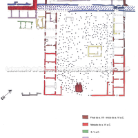
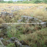
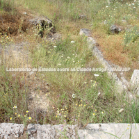
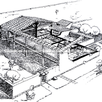
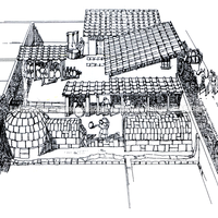
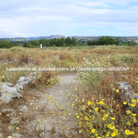
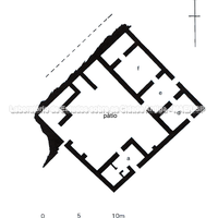
The best-known residential sector of Locri is Centocamere, where a group of blocks with dwellings can be seen opening onto a large plateia 14 m wide. This plateia runs east/west along the harbour in the Parapezza area. North of the great road, long narrow blocks of regular dimensions (27 metres wide) were excavated, separated by stenopoi 4 to 4.50 metres wide (only two blocks have a frontage of 13 metres). The urban organisation of the area is not uniform (Costamagna; Sabbione, 1990: 114). South of the plateia, the five excavated blocks have different shapes and dimensions, perhaps because they were laid out in a peripheral zone, the result of adapting the regular layout to a leftover area. In the blocks there are groups of simple dwellings following the same plan (an entrance room and two small rooms at the back), with a large number of kilns for producing vases, bricks, tiles, architectural revetments and figurative terracottas. The kilns were built of unfired clay and had a circular combustion chamber 4 metres in diameter; they were set within the residential structure – the space also used for the workshop proper, with wells, channels and tanks for preparing clay and producing the objects. The use of the area as a potters' quarter covers the period from the 6th to the 3rd century BC, as indicated by the clay finds made on the site (Cerchiai, 2004: 96 and 98; Greco, 2008: 154-155).
Until the mid-3rd century BC the quarter was occupied only by craftsmen, as shown by the numerous kilns and the objects produced. In the second half of the 3rd century BC the southern part of the quarter was altered. The kilns were dismantled and the interior of the blocks was divided into plots ranging from 120 to 250 m². Houses came to be built around an open central courtyard. The residential part included two storerooms, rooms used as stables and, in larger houses, quarters for slaves (Cerchiai, 2004: 98 and 100).

Bibliography (8)
  • Mertens, D.; Città e monumenti dei Greci d’Occidente.
  • Labeca,; Foto Acervo Labeca
  • Nevett, L. C.; House and society in the ancient Greek world.
  • Greco, E.; Magna Grecia: Guide archeologique Laterza
  • Florenzano, M. B. B.; Relatório científico de viagem ao exterior
  • Longo, F.; Jannelli, L.; Cerchiai, L.; The Greek Cities of Magna Graecia and Sicily.
  • Carratelli, G. P. (ed.); The Greek world: art and civilization in Magna Graecia and Sicily.
  • Sabbione, C.; Costamagna, L.; Una città in Magna Grecia. Locri Epizefiri: Guida Archeologica.

Forms of occupation of the ásty

Walls and position of the gates

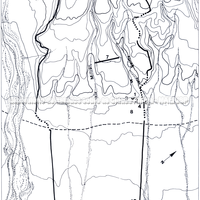
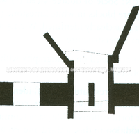
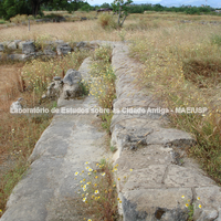
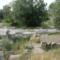
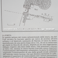
Locri was enclosed (in the 4th and 3rd centuries BC) by a wall circuit of c. 7.5 km. The walls were 2.5–2.8 m thick and made of stone and mud brick. Archaeologists have been able to define two phases in the construction of the walls. The oldest dates from the mid-6th century BC and was contemporary with the planning of the urban scheme, when the walls enclosed only the area of the lower city. Parts of the wall of this period have come to light in the southern sector near Centocamere and in the eastern sector in the Parapezza and Marasà area, and the gates have been recognised in these sectors. On the south side of the wall, towards the sea, there was a monumental entrance dated to the end of the 6th century BC, consisting of a propylon in antis and a central column, set on a pavement of solid blocks. On the east side the access was a simple gate opening at an angle to the wall. At Centocamere the walls made an acute angle to the east to avoid the U-shaped Stoa, located outside the urban area. The building is so close to the wall that the defensive value of the wall is doubtful. At least on the south side the wall seems to have been built to mark the limit of the urban area and to assert political and cultural influence over the harbour area (Greco, 2008: 141; Cerchiai, 2004: 95).
The second phase of construction of the walls took place between the 4th and 3rd centuries BC, when the wall was rebuilt reusing the older structure, reinforced with mud bricks. An example of this type of structure can be found at Centocamere, where the more recent part incorporated the older one. In this phase the Hellenistic wall extended from the sea to the highest part of the polis inland. And the defensive system in the hilly sector had walls following the crests of the hills, protecting the valleys below, blocking and channelling the flow of the river with barriers. On the tops of the Castellace and Mannella hills, large square towers dominated the area, providing wide control of the territory (Cerchiai, 2004: 96).
Four gates have been identified to date: to the north in the Parapezza necropolis, in the Marasà area; to the south at Quota San Francesco, corresponding to the Dromos; and two others at Centocamere on the coastal side (Greco, 2008: 141).

Bibliography (6)
  • Mertens, D.; Città e monumenti dei Greci d’Occidente.
  • Labeca,; Foto Acervo Labeca
  • Frederiksen, R.; Greek City Walls of the Archaic Period, 900-480 BC (Oxford Monographs on Classical Archaeology)
  • Greco, E.; Magna Grecia: Guide archeologique Laterza
  • Florenzano, M. B. B.; Relatório científico de viagem ao exterior
  • Longo, F.; Jannelli, L.; Cerchiai, L.; The Greek Cities of Magna Graecia and Sicily.