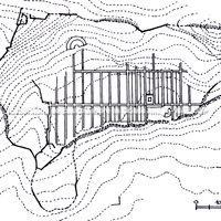
Plan of Kassope. Grid laid out between the end of the 5th and the beginning of the 4th century BC. Grid with a primary coordinating axis. (Bollati)
Full-size image restricted
Nausitoo images are intended exclusively for academic research and teaching. To view them at full size, register and accept the Terms of Use, or sign in.