Hipponion

Italy (South) (Bruttium)

Hipponion was an apoikia founded by Locri. Archaeological evidence indicates its foundation in the 7th century BC. In the territory, mainly in the area between the city and the coast, pottery finds indicate Greek presence from the 6th century onwards. The coastal khóra of Hipponion was consolidated by the 5th century: the evidence is a coastal sanctuary (dedicated to Persephone?) and 5th- and 4th-century BC remains of agricultural and maritime structures. The coastal plain, between Nicotera and the river Angitola, covers about 120 km², but the territory of Hipponion would have covered about 200 km² if the valleys south of the city were part of it. (Hansen, 2004:261) Under Roman rule this polis was renamed Vibo Valentia, the name by which it is still known today.

Relationship between ásty and khóra

Structures between ásty and khóra: walls, necropoleis, sanctuaries.

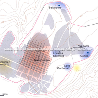
"Hipponion was founded on a very steep plateau, approximately 500 metres above sea level. There are no traces of Greek urban planning or housing structures, which may have been obliterated by the medieval town. However, the surviving remains of a wall circuit of approximately 6 km and the morphology of the site indicate a fortified area forming an enclosure of roughly 80 ha. The urbanised area, presumably the size of the medieval town, covers about 40 hectares. The city probably had an urban plan similar to that found in other Greek apoikiai, with unoccupied open spaces." (Hansen, 2004:262)
Bibliography (3)
  • Hansen, M. H. (ed.); Nielsen, T. H. (ed.); An Inventory of Archaic and Classical Poleis.
  • Mertens, D.; Città e monumenti dei Greci d’Occidente.
  • Carratelli, G. P. (ed.); The Greek world: art and civilization in Magna Graecia and Sicily.
Forms of occupation of the khóra

Structures marking the extent of the territory

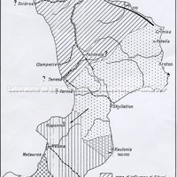
The whole hinterland of southern Calabria, with coastlines on the Tyrrhenian and Ionian Seas, was disputed between the various Greek cities established there: Rhegion, Locri, Kaulonia, Croton, Sybaris. This whole region had indigenous populations which, influenced by the Greeks, joined or supported one polis or another.

Bibliography (1)
  • Lombardo, M.; Greci e indigeni in Calabria: aspetti e problemi dei rapporti economici e sociali

Forms of occupation of the ásty

Sacred areas: deposits, temples, shrines, sanctuaries, altars

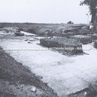
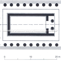
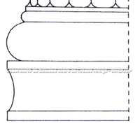
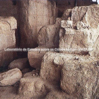
The sanctuaries lie mainly along the eastern and northern edges of the plateau, a "sacred belt" system known, for example, at Akragas and Locri. To the north, on top of the "Belvedere - Telegrafo", a temenos of the mid-6th century BC with naiskoi and a Doric peripteral temple of the end of the 6th century was located. To the east lies the "Contrada del Castello" temenos; and on the Cofino plateau an Ionic temple of the end of the 5th or beginning of the 4th century was found (Hansen, 2004: 262)

Bibliography (1)
  • Mertens, D.; Città e monumenti dei Greci d’Occidente.

Forms of occupation of the ásty

Walls and position of the gates

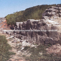
The wall circuit has four structural phases: the first phase (A), of the 6th–5th centuries BC, had foundations built of rubble, possibly supporting a brick superstructure. The second phase (B), of the 5th–4th centuries BC, consisted of an ashlar wall with rectangular towers, unusually positioned in the wall. The destruction and later enlargement of this phase is possibly connected with the destruction by Dionysius I in 388 and the later refoundation of the city sponsored by Carthage (Hansen, 2004:262)

Bibliography (1)
  • Mertens, D.; Città e monumenti dei Greci d’Occidente.