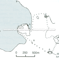
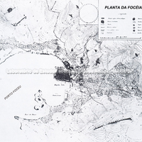
Plan of the city of Phocaea and its surroundings, with the harbour highlighted.
Bibliography (1)
- Institut, D. A.; Archäologischer Anzeiger. (1969)
Asia Minor (Ionia)
The territory of the city of Phocaea, in Ionia (Asia Minor), a region of present-day Turkey, included the area of the peninsula and a group of islands with a harbour, called Karteria. The city belonged to the Delian League during the 5th century BC and had good relations with the king of Tartessos (a prosperous region of the Iberian Peninsula, probably in the Guadalquivir valley), Arganthonios, who is said to have contributed financially to the fortification of the settlement. With the foundation of Massalia, in the western Mediterranean, we learn from the textual sources (such as Thucydides) that the city had a large naval fleet – which proved useful when the Phocaeans had to abandon the city following the Persian conquest of the site.
Borders
Plan of the city of Phocaea and its surroundings, with the harbour highlighted.
Building techniques
Architectural details found at Phocaea; Félix Sartiaux's excavations revealed a great abundance of architectural fragments of the Archaic period, giving a glimpse of the public architecture of the ancient settlement.
 Archaic column drum, found at Maltepe.
 Stretch of paving built of large stone blocks discovered by F. Sartiaux, posing beside…
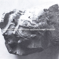 "Phocaean" terracotta sima, found at Kebren.
Forms of occupation of the ásty
The temples of Phocaea were part of its public architecture, and remains of an Archaic temple of Athena have been discovered. It is assumed that this temple originally stood on a rock platform at the tip of the peninsula; Akurgal (1956: 6-8) assumed that it was destroyed by Harpagus and perhaps repaired a little later. The temple of Athena is said to have burned in 409/8 BC and been rebuilt in the Hellenistic period; there are also remains of a temple of Cybele/Artemis, discovered by Özyiğit.
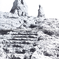 Stone sanctuary.
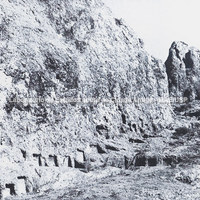 Stone sanctuary, seen from another angle.
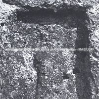 Stone relief, found in one of the niches of the sanctuary.
 Capital of the Temple of Athena, dated to about 580 BC.
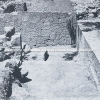 Entrance of the Temple of Athena, dated to about 580 BC.
Forms of occupation of the khóra
Walls on top of the hill, along the coast; there are about 3–9 km of foundation remains incorporated into the peninsula, following the outline of the relief. The total area, established from the reconstruction drawn by Rune Frederiksen, covers about 50 ha. Cuttings in the rock suggest the existence of towers, also built of large ashlar blocks (squared dressed stone), for retaining.
Reconstructions
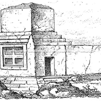
Reconstruction of a stone monument 7 km west of present-day Foça; the tomb, dated to around the 4th century BC, was cut into the rock, is 4.5 m high, and is linked to ancient Anatolian traditions. Called the "Devil's Baths" (Akurgal:118), this tomb probably belonged to a tyrant who ruled a small area of the region in the 4th century BC.