Kaulonia

Italy (South) (Bruttium)

Kaulonia was founded by Achaean colonists between the end of the 8th century BC and the beginning of the 7th, in an area not previously inhabited, and lived autonomously and prosperously for about three centuries, until in 389 BC it was conquered and destroyed by Dionysius I, tyrant of Syracuse. Rebuilt, the city enjoyed a short period of peace, which was shaken during the 3rd century BC by a series of events culminating in its conquest by the Romans in 205 BC. The site nevertheless survived under the name of Stilida, as a stopping place on the coastal road linking Croton to Rhegion. The city never developed enough to become an economic power, perhaps because of its location very close to larger and more influential cities such as Croton and Locri.
On the organisation of space at Kaulonia, see also the website www.labeca.mae.usp.br, under the bibliography tab, site panels.

Building techniques

Architectural details

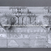
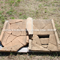
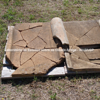
Here we can see details of the roof tiles, the only type of fired brick used in building the houses. The tiles were produced in pottery workshops, and the firing process made them more waterproof.
Bibliography (2)
  • Labeca,; Foto Acervo Labeca
  • Florenzano, M. B. B.; Relatório científico de viagem ao exterior
Forms of occupation of the khóra

Structures marking the extent of the territory

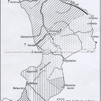
The whole hinterland of southern Calabria, with coastlines on the Tyrrhenian and Ionian Seas, was disputed between the various Greek cities established there: Rhegion, Locri, Kaulonia, Croton, Sybaris. This whole region had indigenous populations which, influenced by the Greeks, joined or supported one polis or another.

Bibliography (1)
  • Lombardo, M.; Greci e indigeni in Calabria: aspetti e problemi dei rapporti economici e sociali

Forms of occupation of the ásty

Residential areas

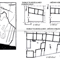
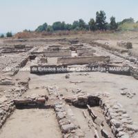
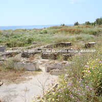
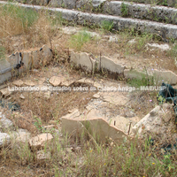
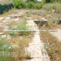
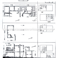
The houses of Kaulonia had standard dimensions that depended on the regularity of the urban grid, divided into equal blocks which in turn were divided into equal plots, each with two houses. The plan was square, about 17 m on each side, with exceptions: the house excavated by Orsi, called "Insula I", occupied more than half the plot, measuring 22.50 m; the "House of the Dragon" occupied the whole plot, measuring 35 m in width. As for the layout, the houses were arranged around a central inner courtyard, with the living room to the west, service rooms to the north and private rooms to the south or south-east. In the more prestigious residences the distinction between the residential and reception parts was more marked: the "Insula I" house, for example, seems to show the distinction between the gynaeceum (the part reserved for women) and the andron (the part reserved for men) mentioned by ancient sources but rarely attested in the domestic architecture of Magna Graecia.
The inner courtyard had an important function in the house: it connected the rooms, provided light and air, and was the setting for many domestic activities. Often the rooms to the west did not open directly onto the inner courtyard but onto its pastás, a corridor with a portico acting as a link between the outer and inner parts and ensuring greater privacy for the rooms at the back of the house.

Bibliography (4)
  • Iannelli, M. T.; Caulonia: note di topografia urbana.
  • Labeca,; Foto Acervo Labeca
  • Bollati, R.; Bollati, S.; Siracusa: genesi di una città. Tessuto urbano di Ortigia.
  • Carratelli, G. P. (ed.); The Greek world: art and civilization in Magna Graecia and Sicily.

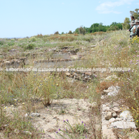
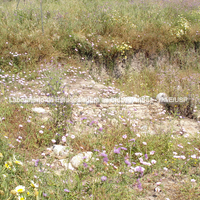
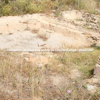
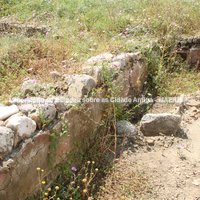
Simple, low-cost materials were used to build the houses. The walls consisted of a foundation footing of stones and pebbles, on which the wall of mud bricks – not fired in kilns, only dried in the sun – was laid. The walls were protected by simple whitewashed plaster. The floors were simple levelled and compacted surfaces, rarely with elaborate coverings such as tiles laid flat; only the rooms of luxurious residences were decorated with mosaics, as the famous "House of the Dragon" attests. The inner courtyard was often paved with pebbles, which ensured good drainage; brick paving is rarer. The houses were completed with wells and drainage channels; there were also small porticoes of light construction, both by the street and inside the courtyard.

Bibliography (2)
  • Labeca,; Foto Acervo Labeca
  • Florenzano, M. B. B.; Relatório científico de viagem ao exterior
Relationship between ásty and khóra

Structures between ásty and khóra: walls, necropoleis, sanctuaries.

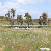
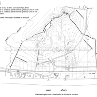
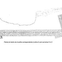
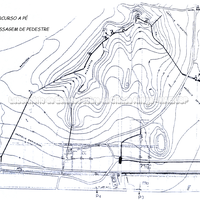
The wall of Kaulonia enclosed a quadrilateral between the lower coastal strip and the hills to the west, especially the Piazzetta hill, identifiable as the acropolis, where a later stretch of internal walls meant that the acropolis was fortified by walls on all sides.
The wall had at least eleven towers, more numerous in the strategically weaker parts, such as the hill sector; their square or rectangular plan served for both defence and attack, as shown by the features designed for the use of war machines.
Gates in the walls gave access to the city. Of the four separate gates, the most complex is on the north-west side, between towers I and II: its pincer-like layout provides an opening set back behind the curtain wall and two towers, one further forward than the other, forming a passage with a transverse obstacle that prevented any enemy from attacking with the right side exposed while holding the shield in the left hand.

Bibliography (2)
  • Labeca,; Foto Acervo Labeca
  • Florenzano, M. B. B.; Relatório científico de viagem ao exterior
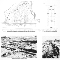
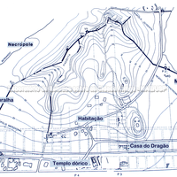
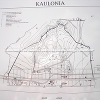
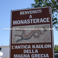
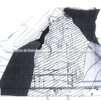
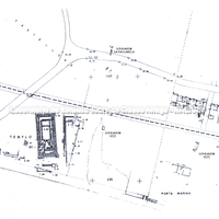
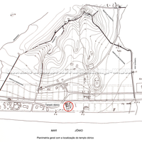
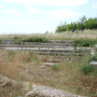
Plans of the settlement showing the main structures and the surrounding khóra. The urban area of Kaulonia, enclosed by a curtain wall with gates and towers, was organised according to a regular urban layout with orthogonal streets delimiting equal blocks. Excavations have brought to light houses, among which the "House of the Dragon" stands out, named after the monster depicted in the polychrome mosaic on the floor of one of its rooms.
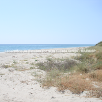
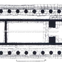
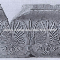
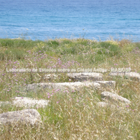
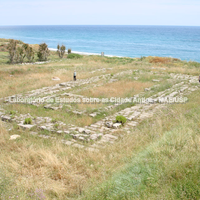
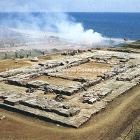
Inside the city a sanctuary characterised by a large Doric temple, whose base is still visible on the beach, came to light. Another distinct sacred area is known outside the city on the hill called Passoliera; from there splendid polychrome architectural terracottas were recovered that decorated the upper part of a temple and of other cult structures. The necropolis areas were outside the walled area: besides the Greek necropolis excavated by Orsi, recent excavations have confirmed the presence of a necropolis of the Bruttii – an Italic population that must have occupied Kaulonia in the 3rd century BC.
As for the territory of Kaulonia, in the Greek period there must have been small rural farmsteads scattered across the countryside; in the Roman period a villa is attested at Fontanelle, related to a territorial organisation based on large estates.
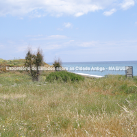
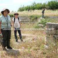
A significant sector of the residential area of Kaulonia can be visited in the Archaeological Park of ancient Kaulonia near Monasterace Marina, close to which is the Antiquarium, which houses a large collection of finds.

Bibliography (5)
  • Mertens, D.; Città e monumenti dei Greci d’Occidente.
  • Labeca,; Foto Acervo Labeca
  • Frederiksen, R.; Greek City Walls of the Archaic Period, 900-480 BC (Oxford Monographs on Classical Archaeology)
  • Florenzano, M. B. B.; Relatório científico de viagem ao exterior
  • Bollati, R.; Bollati, S.; Siracusa: genesi di una città. Tessuto urbano di Ortigia.

Forms of occupation of the ásty

Work areas: workshops

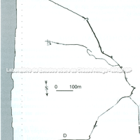
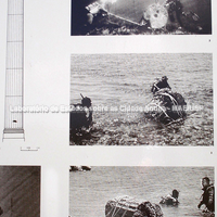
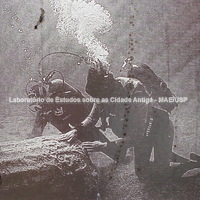
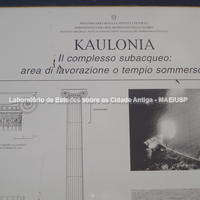
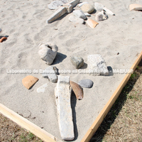
North of Kaulonia, at Punta Stilo, underwater archaeological research has brought to light many elements that help us explore the various aspects of the ordering of space. Numerous hypotheses have been put forward regarding the group of stone material found in the submerged area of "Punta Stilo", but if we take into account the important evidence of rough or semi-worked materials, together with stone chips from working spread over the whole surface, the proposals come down to two.
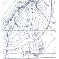
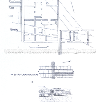
The area could have been a stone-working workshop producing materials for the construction of public buildings, in particular temples, at Kaulonia. The raw material, of Calabrian origin, perhaps from the Stilo-Bivongi mining basin, could have been transported by sea. The heaviest materials were found further from the modern coastline and closer to the ancient one, near the harbour. On the other hand, the lighter materials were found closer to the modern coastline, in an area away from the ancient beach, which makes sense considering that they were easier to transport.
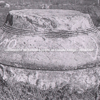
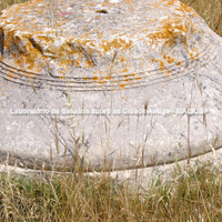
Another hypothesis is that the zone could have been chosen for building a temple of Ionic origin, given the presence of column bases and drums in this style. Such a building would never have been completed, as the semi-worked materials would attest.
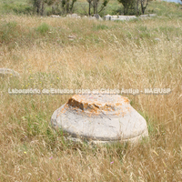
The most important find is the top end of the shaft of an Ionic column, that is, the part at the top on which the capital rested. The upper face is decorated with the so-called "anthemion", a frieze of alternating palmettes and lotus flowers. This piece is comparable to the top of the column shaft from the temple at Marasà in Locri, dated 480–470 BC, from which it differs, however, in its smaller dimensions and the different provenance of the limestone.

Bibliography (1)
  • Labeca,; Foto Acervo Labeca

Forms of occupation of the ásty

Urban grid: acropolis, block, agora, plateiai, stenopoi, orientation

The identification of the site of the Greek apoikia of Kaulonia in the area of present-day Monasterace Marina was already made at the end of the 19th century thanks to the archaeologist Paolo Orsi, who began the research that was resumed in the second half of the 20th century and has made it possible to reconstruct the organisation of the city in its initial outlines.

Bibliography (3)
  • Iannelli, M. T.; Caulonia: note di topografia urbana.
  • Labeca,; Foto Acervo Labeca
  • Carratelli, G. P. (ed.); The Greek world: art and civilization in Magna Graecia and Sicily.

Forms of occupation of the ásty

Sacred areas: deposits, temples, shrines, sanctuaries, altars

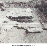
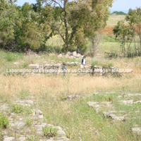
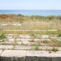
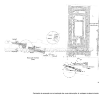
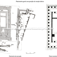
Temple of Apollo. Recent excavations in the area of the Temple of Apollo have brought new elements to light. On the south-east side of the temple, for example, the excavation of an imposing collapse layer is under way, consisting of architectural elements from the upper part of the building (entablature and cornice). These elements are of stone, but decorative terracotta elements have also been found, such as two revetment slabs from the pediment band for the decoration of the roof gutter.
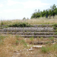
Some marble fragments are noteworthy, perhaps belonging to a sculptural decoration of the acroterion, placed at the corners of the cornices. All these elements, once detached, were gradually covered by natural accumulation, remaining fortuitously preserved from the looting that other elements of the temple on the surface suffered over time, either through reuse as building material or for lime extraction. East of the temple, beneath the coastal dune, a mass of walled structures in ashlar technique was found, parallel and decreasing towards the east, forming a massive substructure for the temple terrace and acting as the boundary of the sacred area. The foundation, however, has no physical relationship with the front staircase on the north side of the temple.
South of the temple, research has focused on a sector that has been studied since the 1960s: the most recent discovery is that, among the structures brought to light at that time, there is certainly a sacred building, whose plan and date have yet to be confirmed.
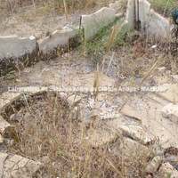
An interesting cult structure was brought to light north of the temple, at the foot of the western end of the staircase: a large rectangular votive pit carefully lined with flat tiles and equipped, at the centre of the bottom, with half an amphora used as a basin, near the three steps on the north. Inside, several layers of deposition were identified, more jugs with intentionally pierced bottoms, for ritual purposes, and animal bones, still being analysed.

Bibliography (4)
  • Mertens, D.; Città e monumenti dei Greci d’Occidente.
  • Labeca,; Foto Acervo Labeca
  • Juliis, E. M. D.; Magna Grecia: L’Italia meridionale dalle origini leggendarie alla conquista romana.
  • Florenzano, M. B. B.; Relatório científico de viagem ao exterior