
Here we see an aerial view and a map of the region of Chalcis on the island of Euboea, the second largest Greek island, showing the famous Euripus strait, only a little over 40 metres long, over which a bridge was built as early as the 5th century BC. In the strait there is a curious phenomenon of tidal reversal that occurs several times a day, which already intrigued Aristotle and has not been adequately explained to this day. Chalcis lay right on the strait, practically touching the mainland. This privileged position placed it at the crossroads of several trade routes, both maritime and overland, which allowed the city to prosper rapidly, also thanks to its bronze industry.
According to M. Gras, the island of Euboea, whose first name was Makris ("the long one"), was integrated early on (10th century) into the life of the Mediterranean, perhaps because of its copper mines (chalkos in Greek, hence Chalcis) and iron mines. The inhabitants of the cities of Euboea travelled to Cilicia, to the plains around Etna and Vesuvius and to the Bay of Naples in search of volcanic, and therefore fertile, land.
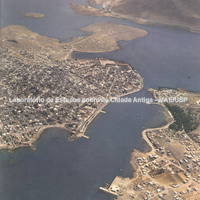 Aerial view of the region of Euboea and the Greek coast corresponding to Boeotia and…
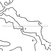 Map of the island of Euboea and the Greek coast opposite. (Boeotia and Attica)
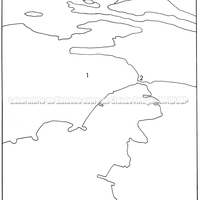 Graphic representation of the region of Euboea with the sites of Chalkis and Aulis, on…
Bibliography (1)
- Schoder, R. V.; Ancient Greece from the Air.